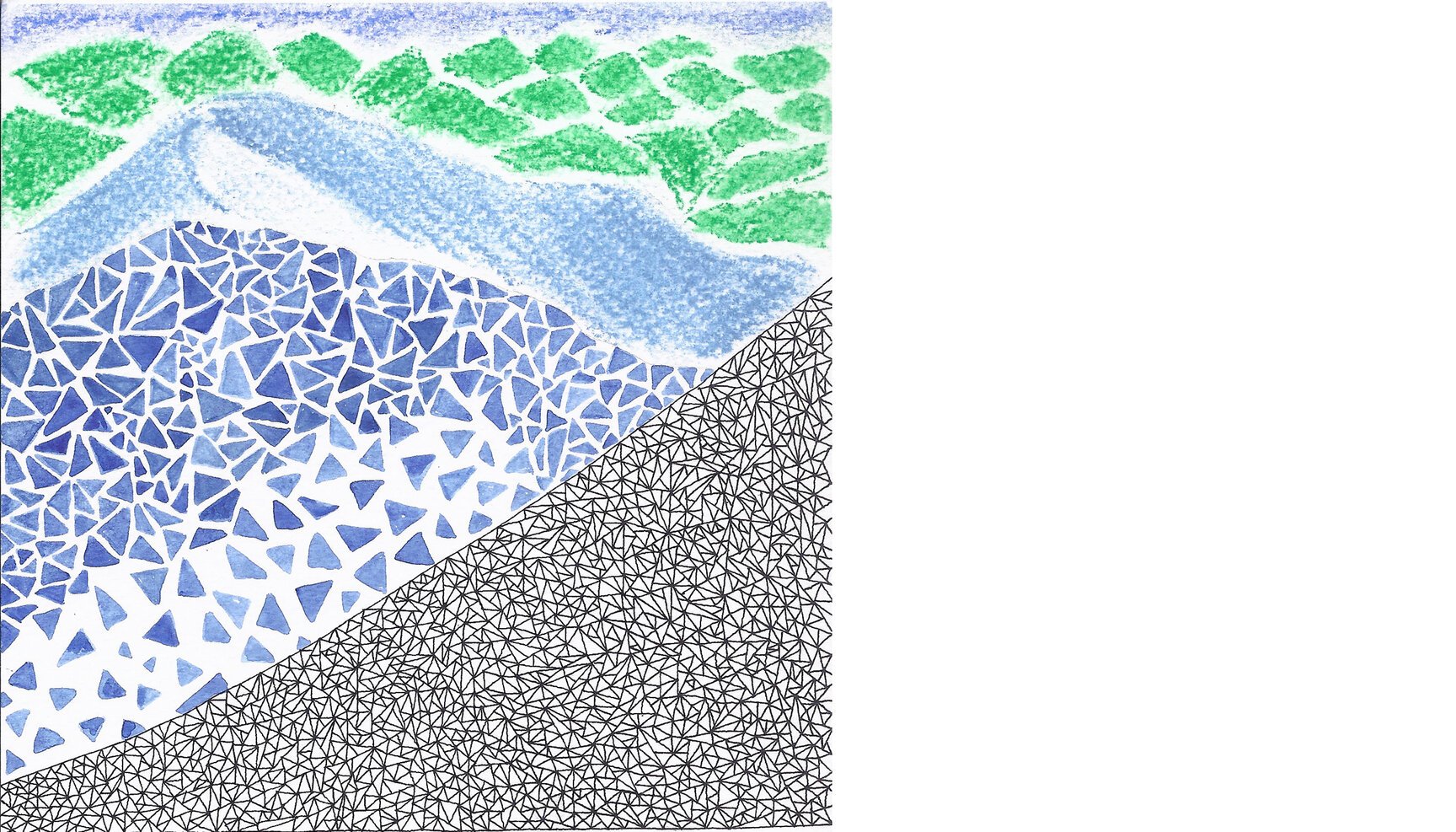
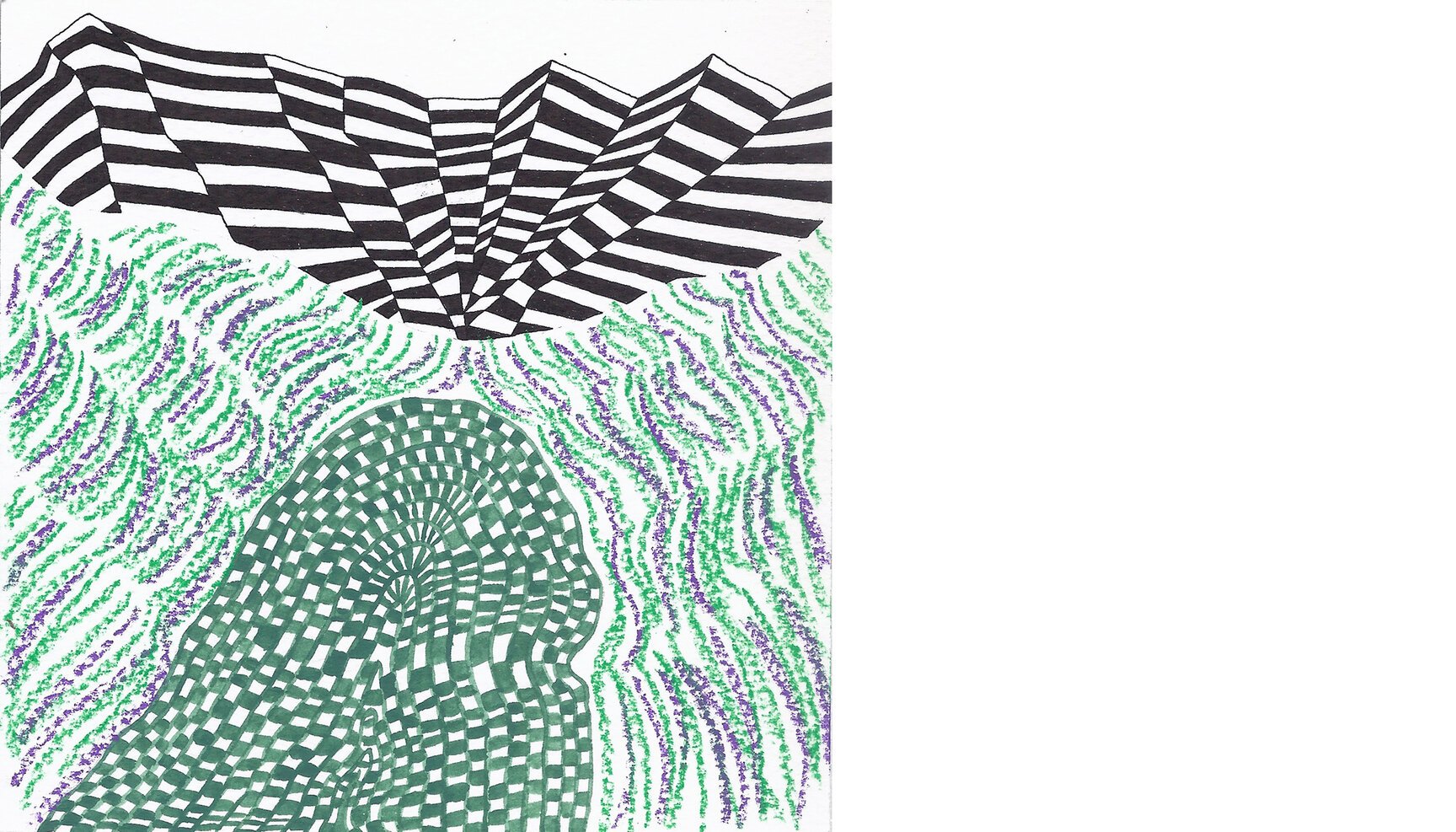
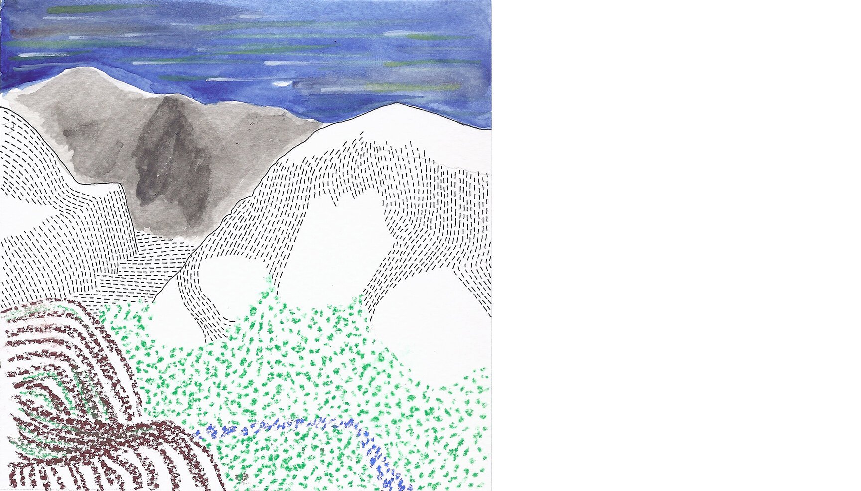
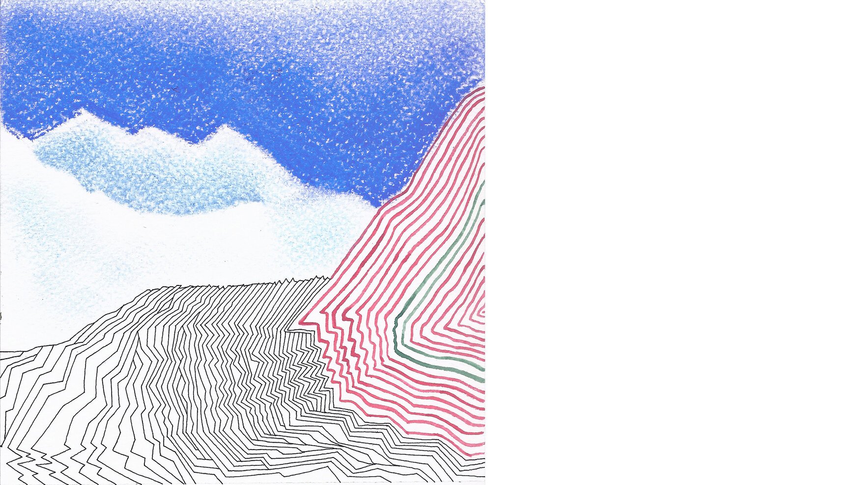
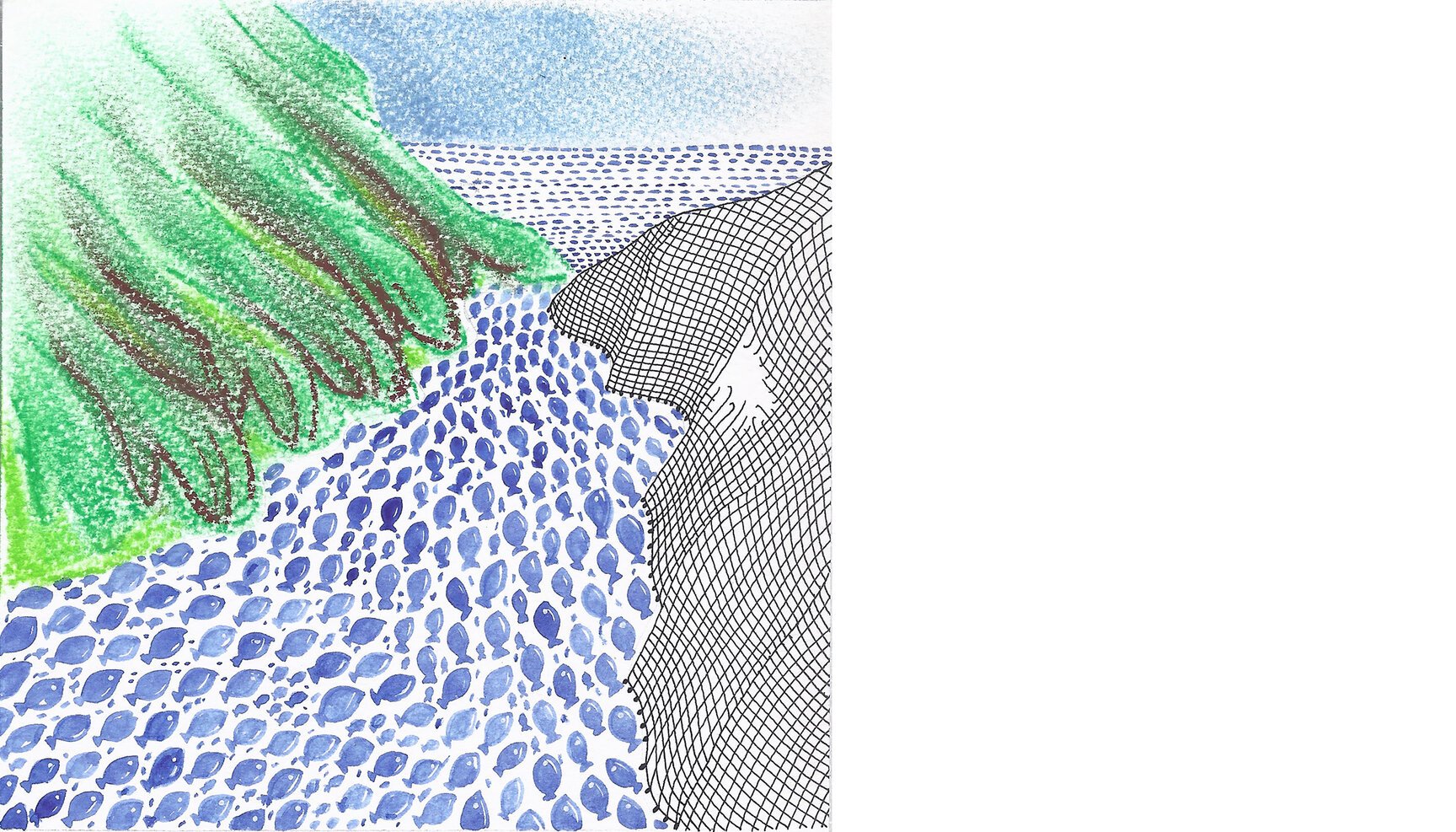
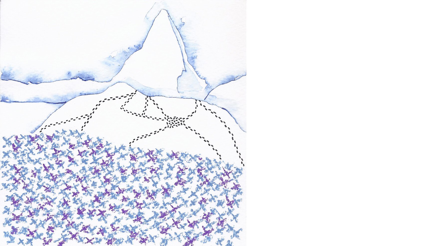
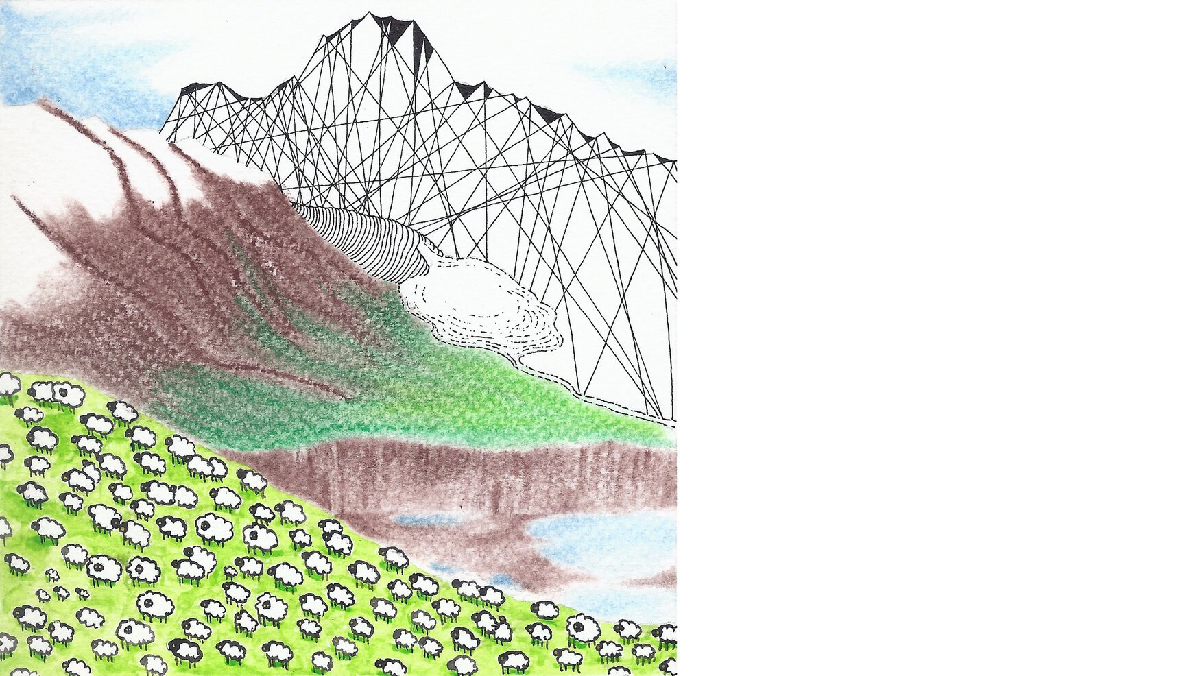
100 Days of Mountains
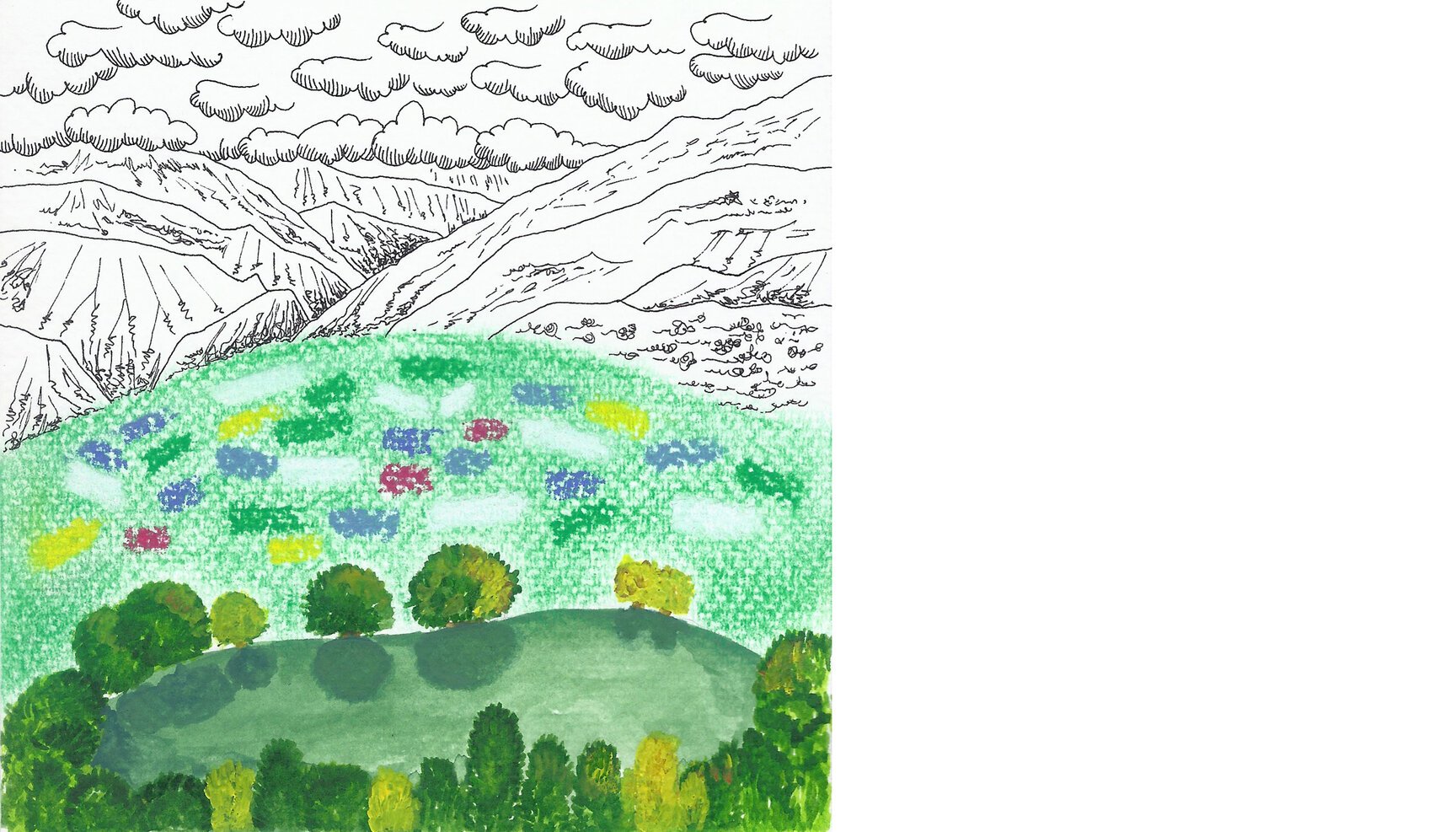
On 6th April 2015 the three of us at tiffinbox started our #100dayproject. The three, mad about all things hilly began to merge our two collective loves: mountains and art.
Project: each of us has picked a tool of illustration. Dwarka is with dry pastels, Rohit has picked ink (rotring) and Sriparna chose water colour. Everyday we pick a scene from Google Earth and create a depiction of that scene on paper through these three tools.
The Process: The first to start selects a scene on Google Earth and then creates a frame of reference while the next person builds on it. And so on.
The hashtag we have picked is #100daysofmountains (this is mainly an instagram project) where you can follow these experimental squares of art, each arising from our collective respect for nature, especially those mighty triangular mounds of earth.
Here goes.
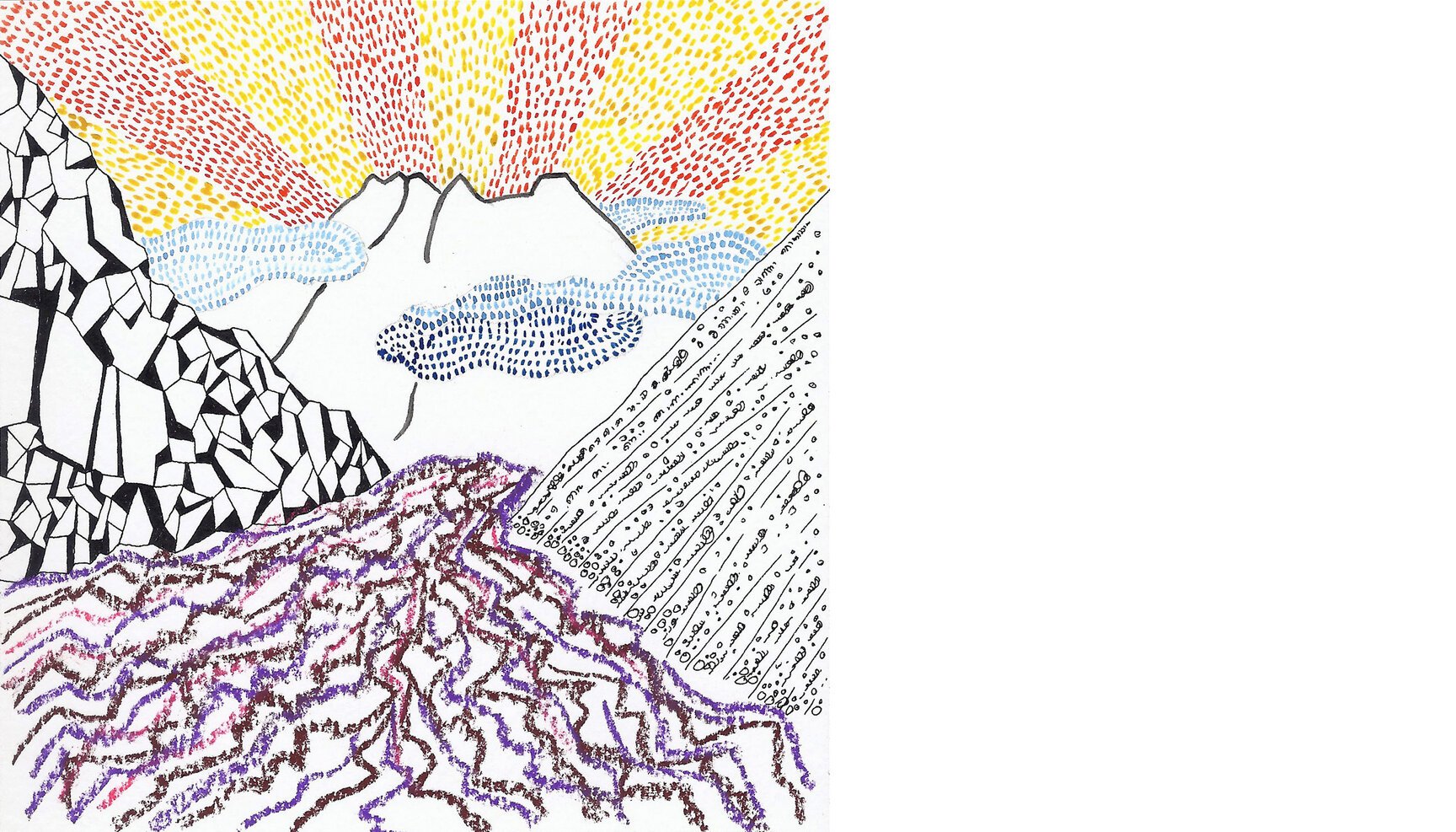
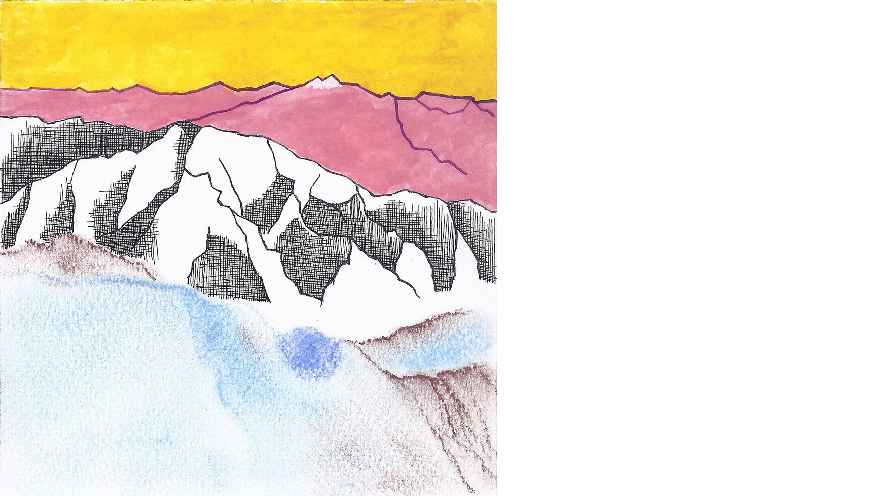
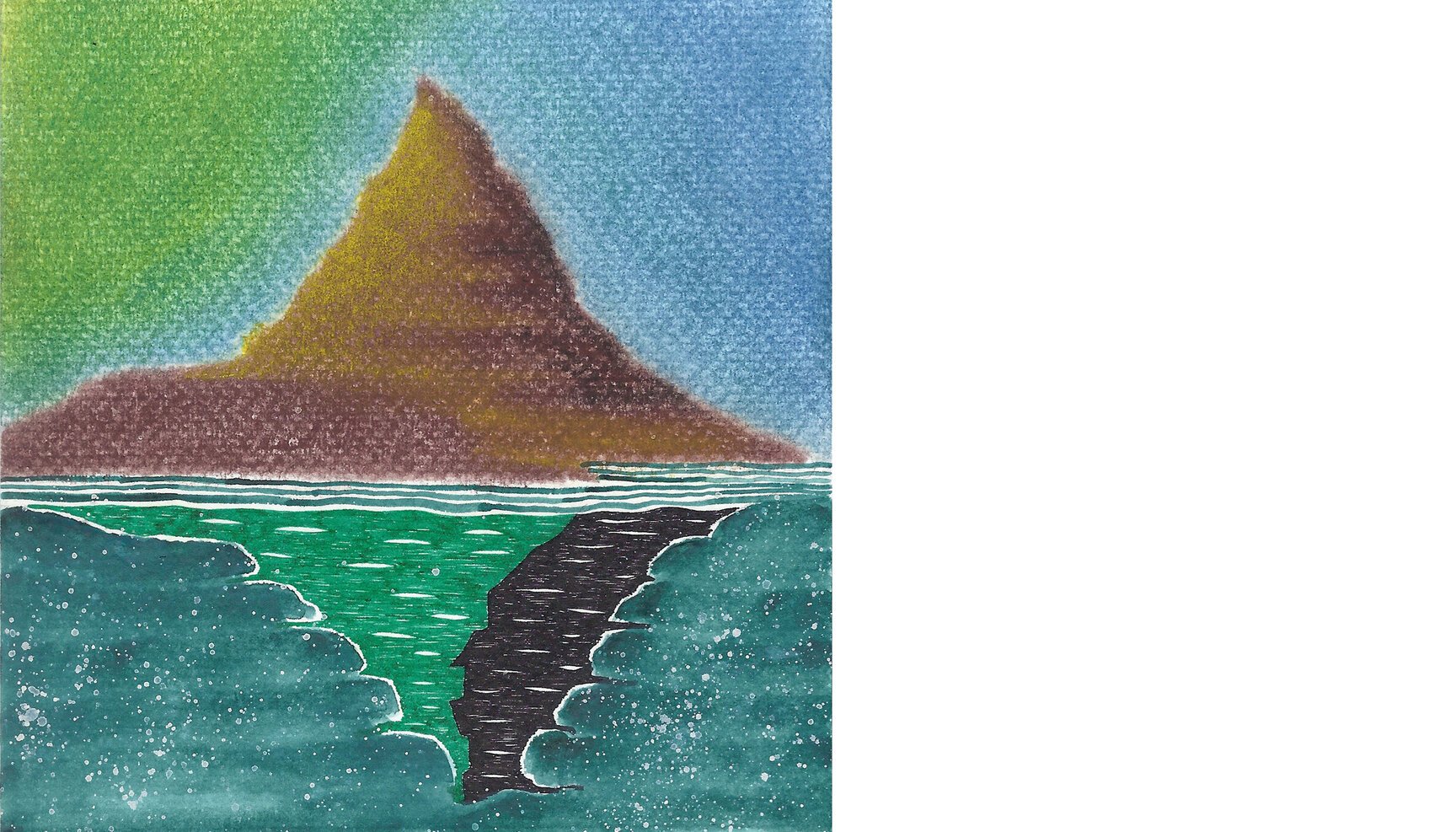
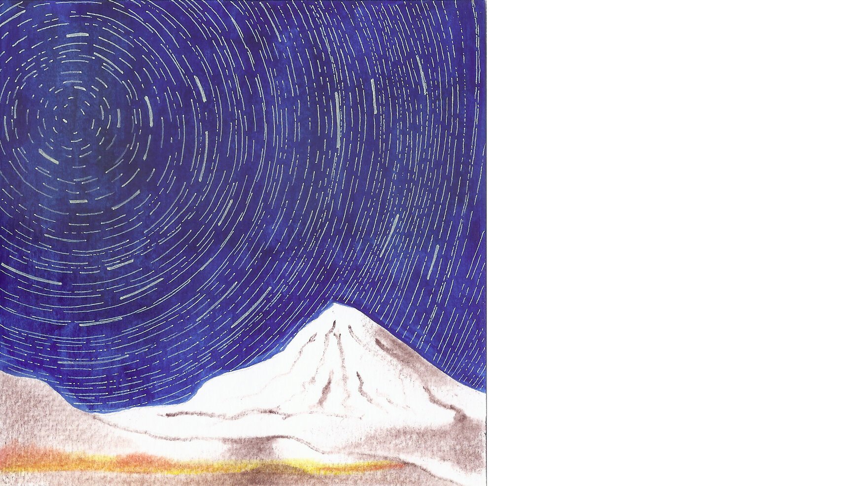
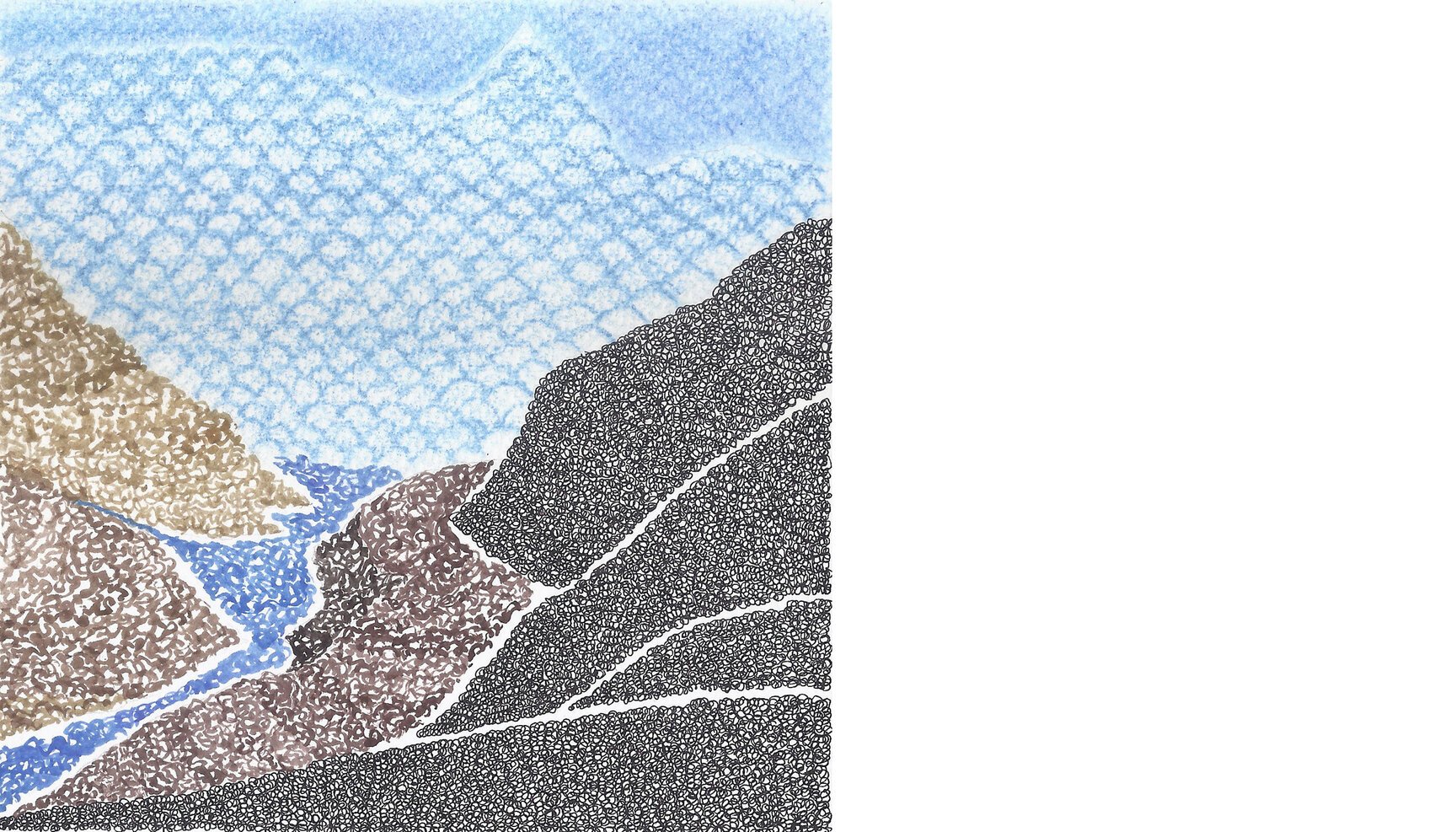
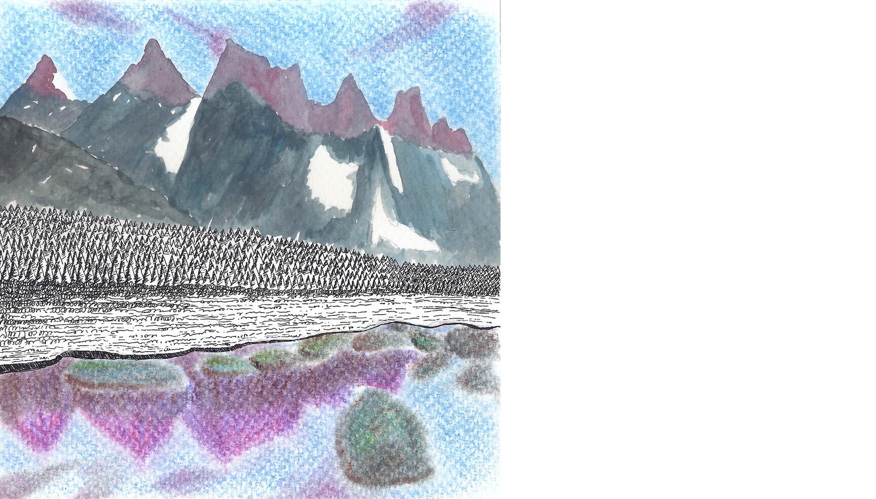
Day 1: Nanda Devi (India)
Day 1 looks at Nanda Devi mountain, beyond the meditative Rotring and the runny water colour, from 30°25’43.70”N 79°47’56.94”E
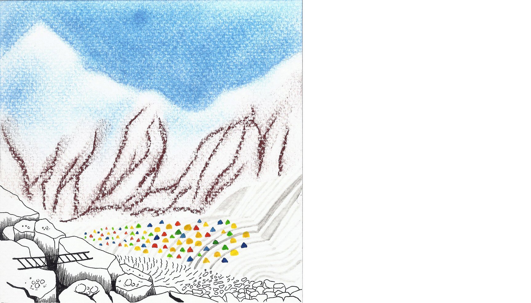
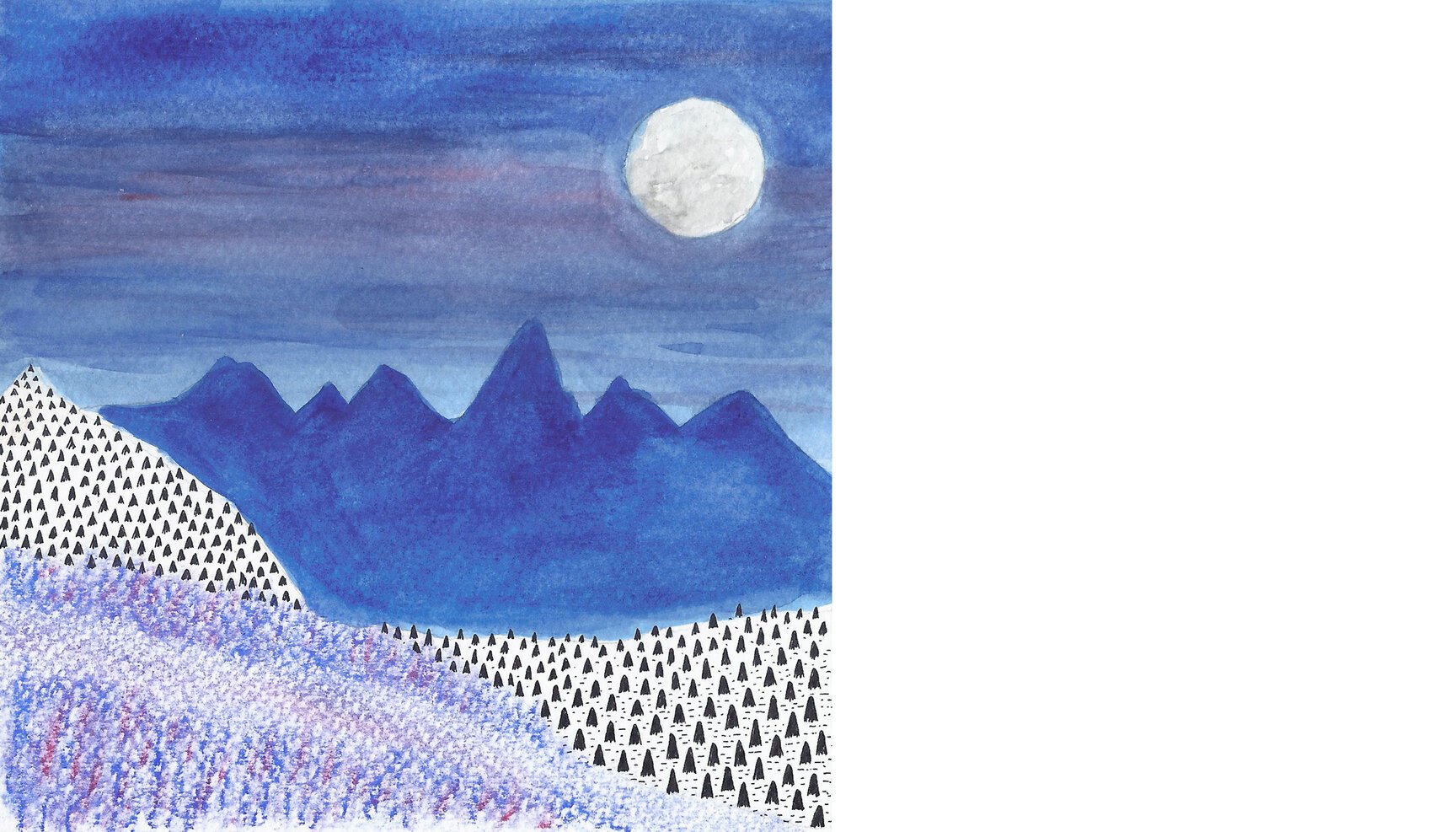
Day 2: Somewhere in Zanskar (India)
Day 2 looks at the high altitude desert of Zanskar from 32°57’05.67” N 77°15’04.86”E
Day 3: Kangchenjunga (India, Nepal)
Day 3 looks at the north-west face of the holy Kangchenjunga, world’s third highest peak, from 27°49’51.32” N 88°04’38.95” E.
Day 4: Stok Kangri (India)
Day 4 looks breathlessly at the vista around Stok Kangri (6153 mts.) peak from 33°59’07.87” N 77°26’37.01” E
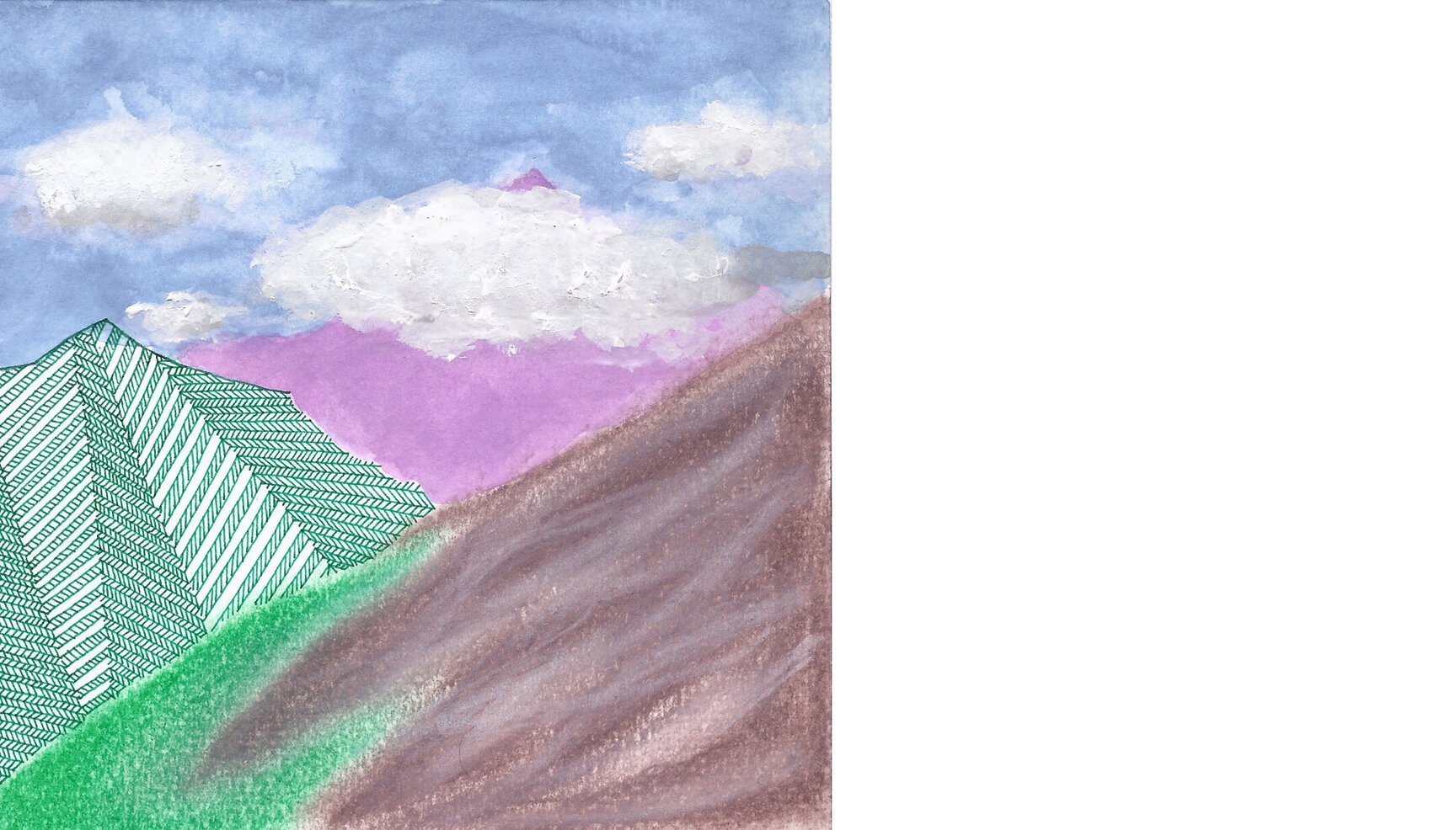
Day 5: Chaukhamba (India)
Day 5 looks at the cold and desolate walls of Chaukhamba mountain massif from the comfort of meadows at Madhyamaheshwar, from 30°38’42.89” N 79°13’13.21” E
Day 6: Nanga Parbat (Pakistan)
Day 6 looks at the Rupal face of treacherous Nanga Parbat mountain from 35°05’51.19” N 74°40’54.67” E.
Day 7: Uluru or Ayers Rock (Australia)
Day 7 looks at the textures and changing colours of sandstone of Uluru / Ayers Rock in central Australia from 25°20’54.53” S 131°02’54.00” E
Day 8: Zillertal Alps (Austria)
Day 8 looks at the Schlegeisspeicher reservoir and Zillertal Alps in Austria from 47°02’30.72” N 11°41’17.16” E. Also, Ive been there in person and this artwork does no justice to the actual view :)
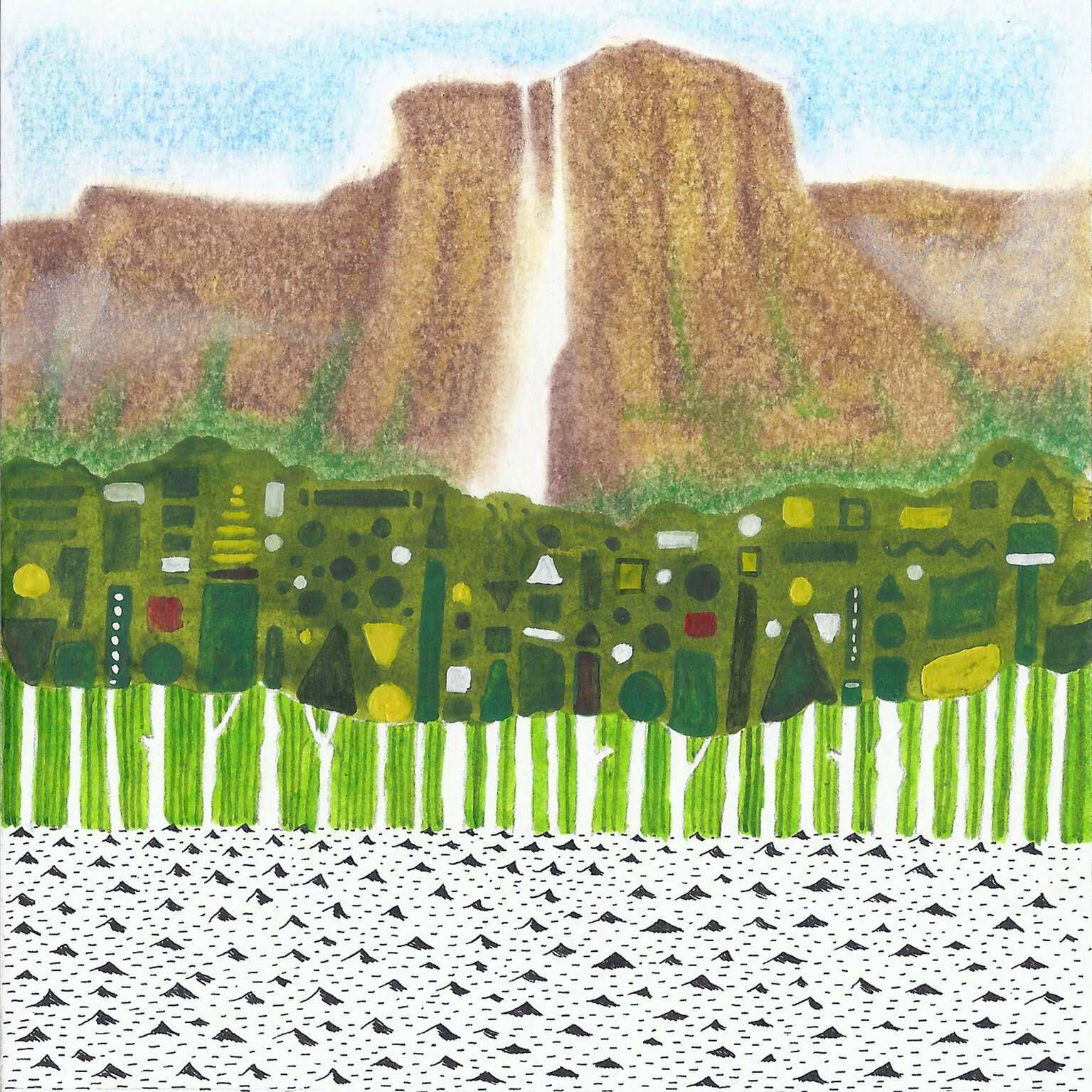
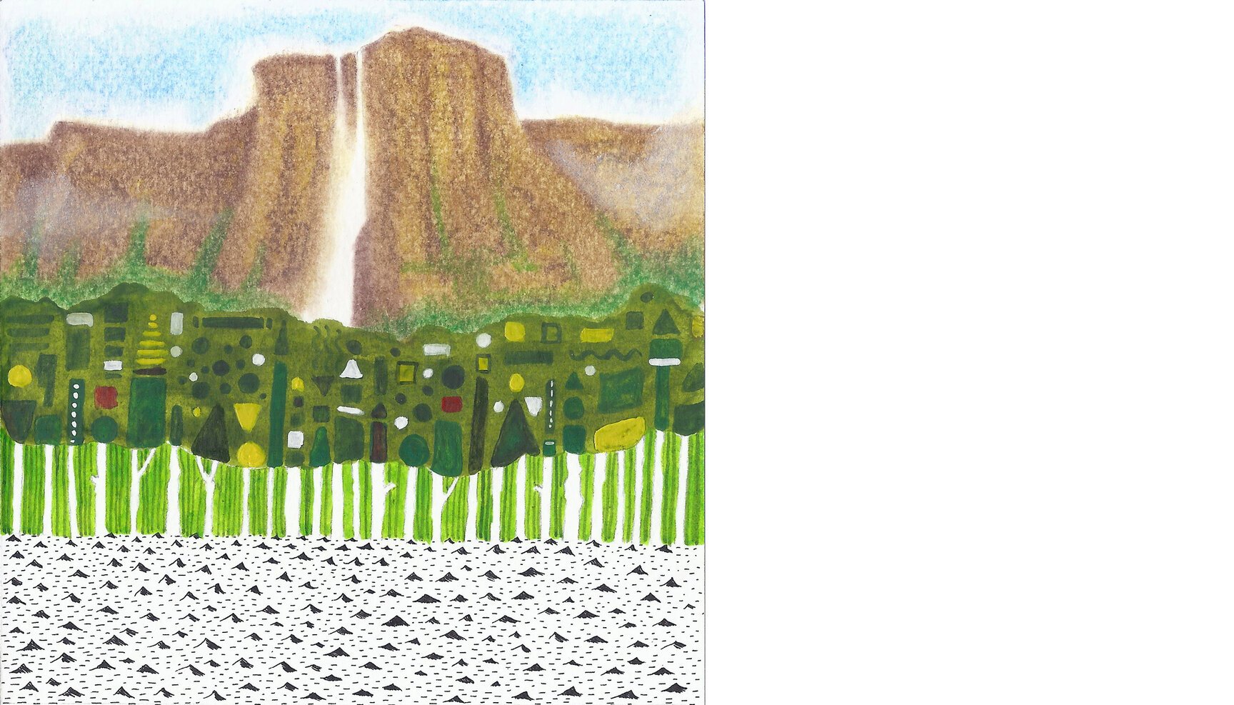
Day 9: Half Dome (USA)
Day 9 looks at the Yosemite Valley and the Half Dome from the edge of the El Capitan (37°44′03″N 119°38′16″W). The Yosemite Valley is where Alex Honnold, one of the best free solo climbers from the US, spends most of his time breaking all possible climbing records. He along with Hans Florine climbed the Nose of El Capitan in a record time of 2:23:51.
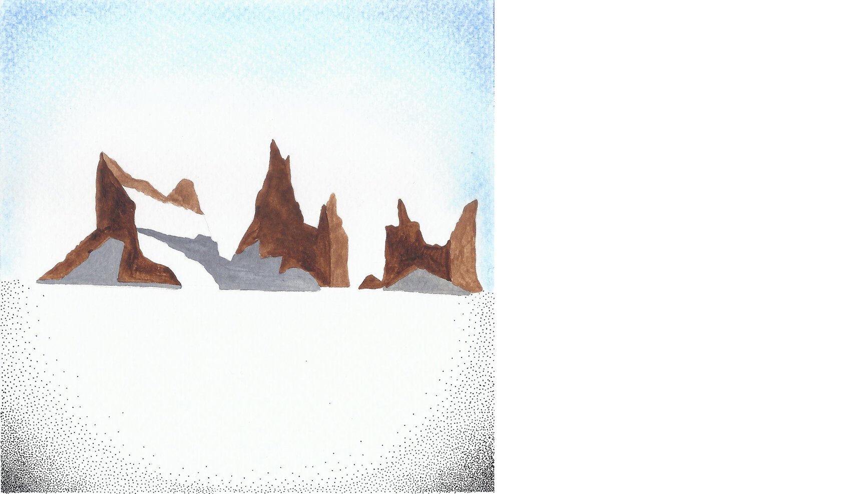
Day 10: Broad Peak (Pakistan)
Day 10 nervously steals a glance of the Broad peak (K3) in the Karakoram mountains from 35°49’55.24” N 76°37’11.64” E, precariously standing on the glaciers roaring down from the Gasherbrum massif
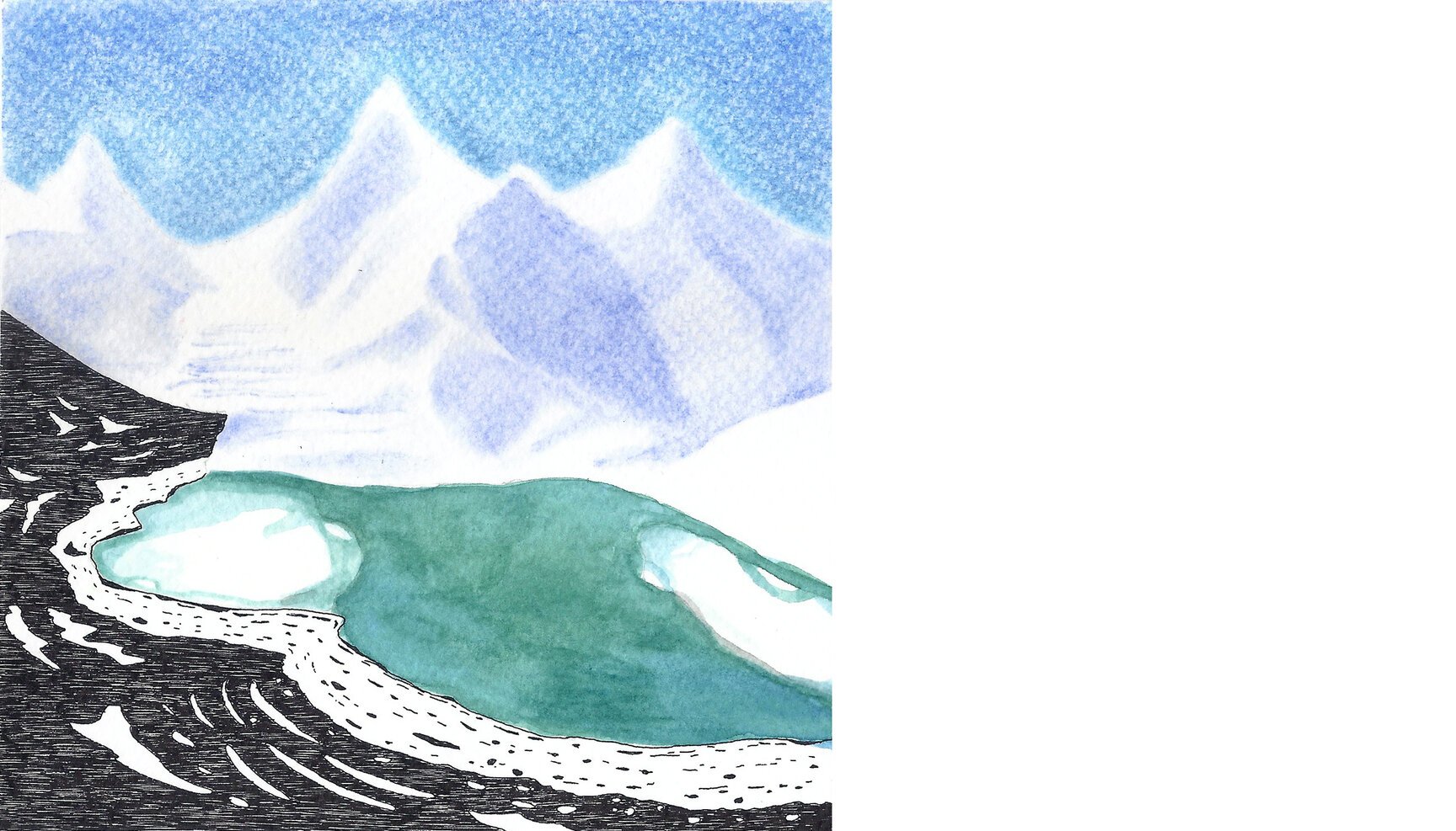
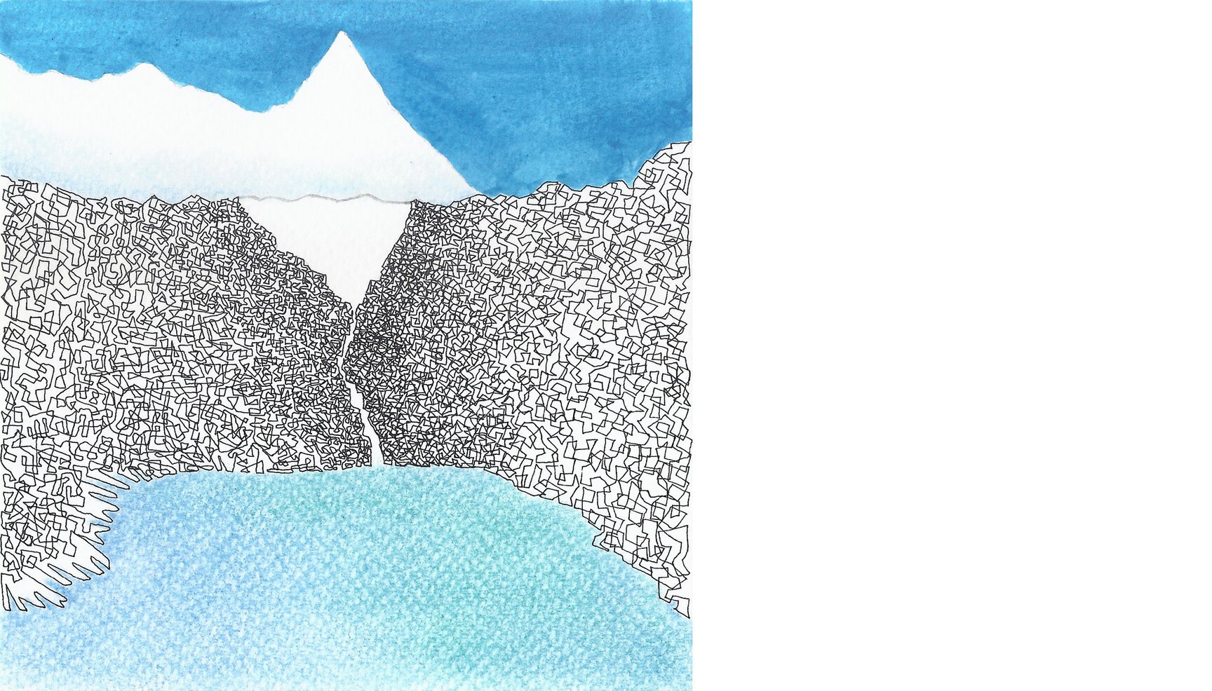
Day 11: Milford Sound (New Zealand)
Day 11 looks at the serene waters of Milford Sound (SW New Zealand) and the mysteries it carries from 44°38’21.29” S 167°55’36.61” E.
So popular is this a tourist attraction that the entire surface of the water body on Google Earth is littered with tiny thumbnails of images taken by visitors. I am not sure about you but that immediately puts me off and away looking for emptier Sounds!
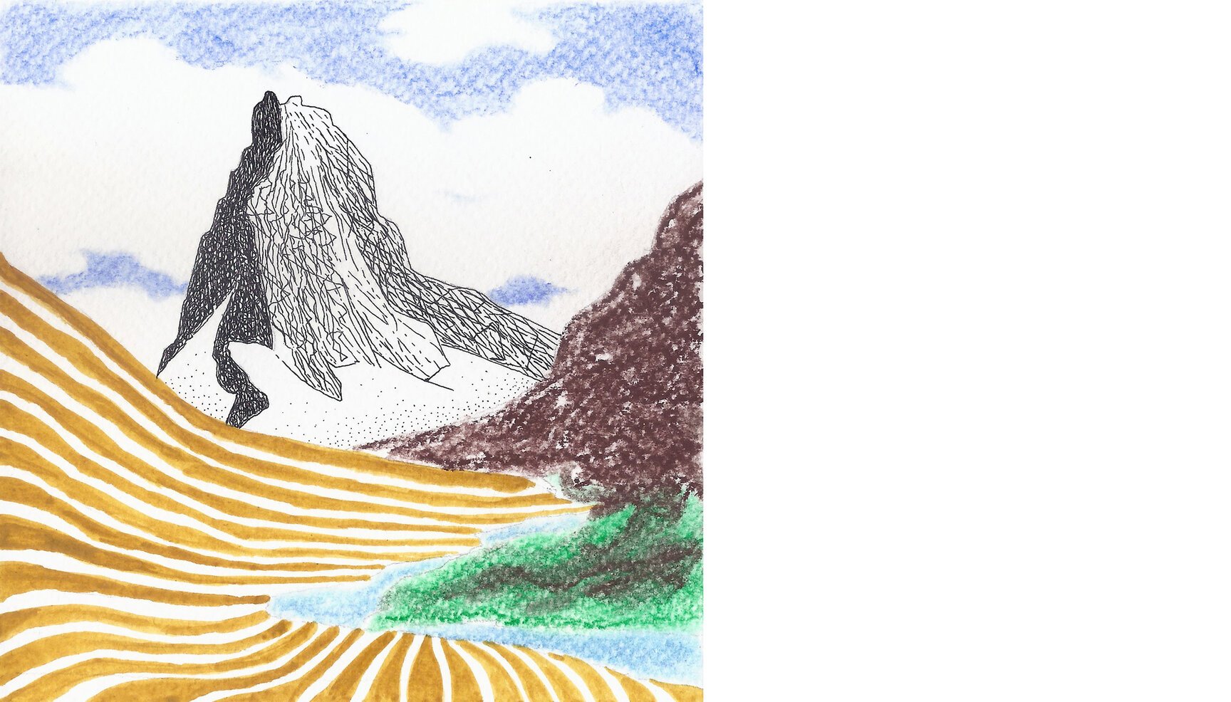
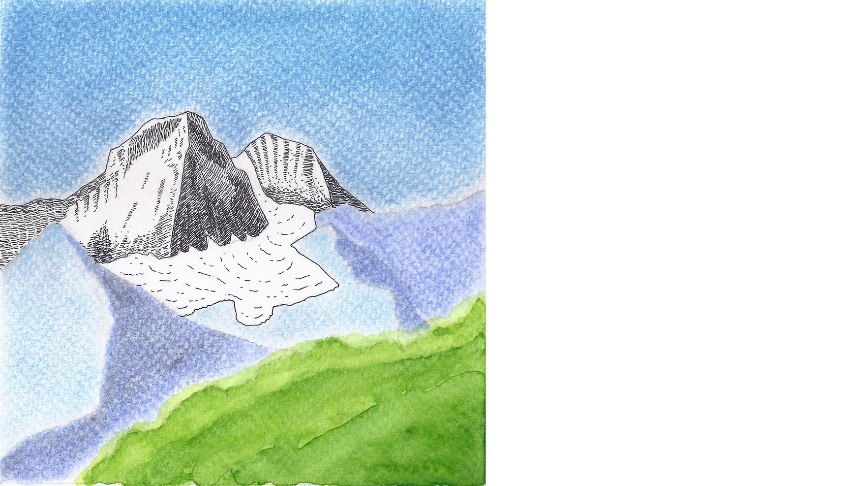
Day 12: Matterhorn (Switzerland, Italy)
Day 12 stares at the Matterhorn, a beautiful peak lying between Switzerland and Italy, from 45°59’27.55” N 7°42’34.41” E.
Though it is not as high and difficult as the great Himalayan peaks, it still challenges the best of climbers especially on the north face. Ueli Steck, a Swiss rock climber and mountaineer, is famous for speed climbing and summitted the Matterhorn in less than two hours where it usually takes anything from four to five hours atleast.
Day 13: More Plains (India)
Day 13 looks at the wide expanse of More plains, a stretch of barren wilderness at an average altitude of 4800 mts, from 33°08’25.18” N 77°47’38.81” E
With no fixed/tarred road and innumerable dirt tracks, people usually go crazy with excitement on this 40 km long stretch of the iconic Manali-Leh highway!
Day 14: Moraine Lake (Canada)
Day 14 looks at the famous Moraine lake located in the Valley of the Ten Peaks from 51°19’35.92” N 116°10’52.62” W. Fresh from the travelling Banff Mountain Film Festival last weekend here in Delhi, we had to visit this beauty on Google Earth. The lake reflects a very distinct colour of blue which is due to the refraction of light off the rock flour deposited in the lake on a continual basis (wikipedia). The highest of the ten peaks is Deltaform Mountain at 3,424 mts.
Day 15: Cerro Torre (Argentina, Chile)
Day 15 stares at Cerro Torre, a frightening yet beautiful peak in the southern Patagonian ice field in South America, from the glacier on the western side at 49°16’35.65” S 73°08’07.45” W. The peak lies between Argentina and Chile. For a long time it was considered as the world’s hardest mountain to climb due to extreme climate, hundred-knot wind and near vertical slopes. A google image search reveals, for the first timer, a rather scary and other-worldly experience. We wonder what it would be like standing right under it.
Day 16: Anaimalai Hills (India)
Day 16 visits the Nilgiris and stares through an opening in the forests of Anaimalai hills from 10°18’43.68” N 77°00’36.52” E.
Anaimalai, or the elephant hills, overlooks the tea estates of Valparai below and the ecologically rich and threatened Shola forests and grasslands of Akkamalai beyond. Shola (Tamil for grove) grasslands are characterised by frost- and fire-resistant grass species! How cool is that!
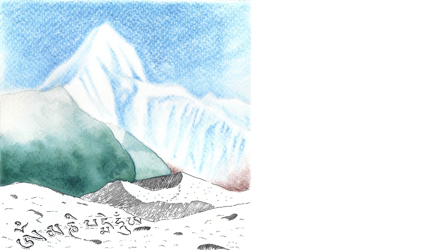
Day 17: Mount Everest (Nepal)
Day 17 looks up at Mt. Everest from its North Base Camp, 28°08’31.10” N 86°51’04.79” E situated in Tibet. It is at an elevation of 5,150 metres and is used when climbing the Everest via North Col and the northeast ridge. An attempt at the first ascent of the world’s highest mountain was made through this route as Nepal was closed to foreigners at that time (1921, 1922 and 1924). The 1924 climbers Mallory and Irvine perished on the mountain and it is still a mystery whether they reached the summit or not. Decades later, the first official ascent was made in 1953, but through the south side.
This camp is situated at the base of Rongbuk Glacier. Cars (and tourists) can go upto almost touching distance of the north base camp (not cool at all!)
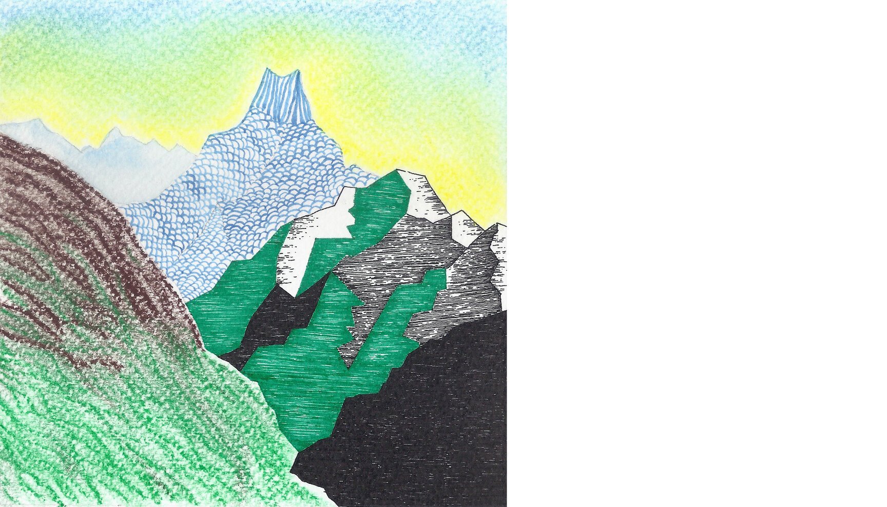
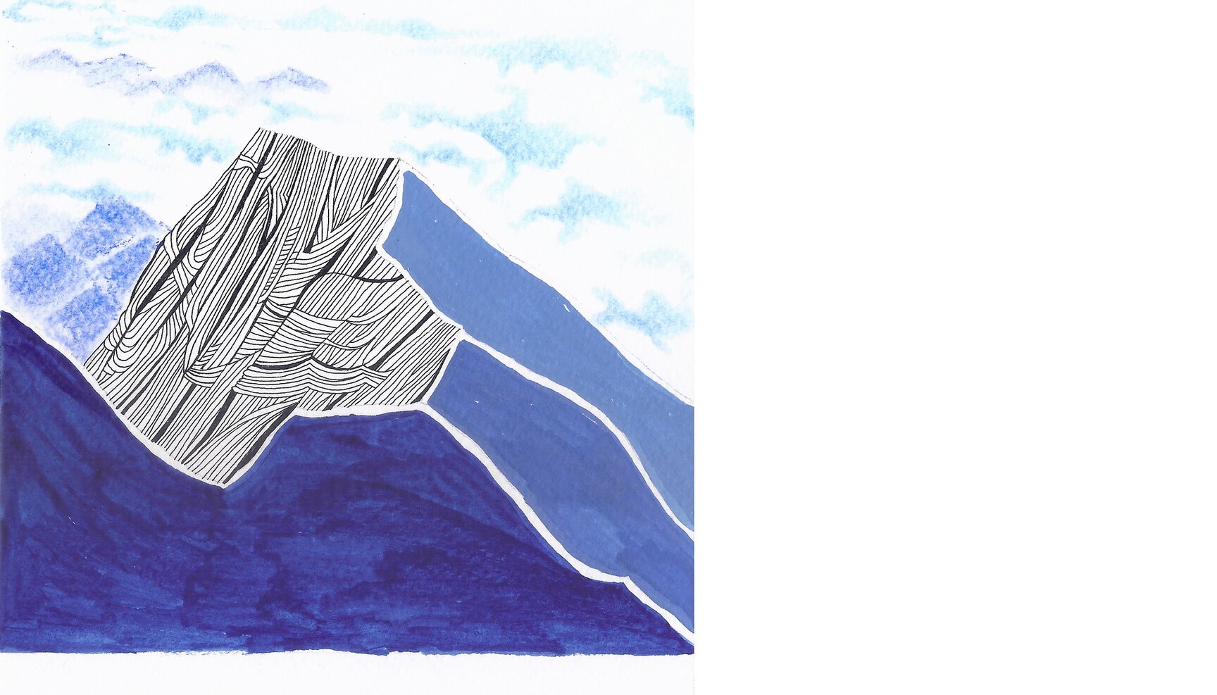
Day 18: Mont Blanc (Italy, France)
Day 18 looks at Mont Blanc (white mountain), the highest mountain in the Alps from 45°57’10.82” N 6°50’59.67” E with Chamonix town on the bottom left. Chamonix was the venue for the first winter Oympics in 1924. Having recently read the horrific news of China trying to make a road under the Mt. Everest, it was quite coincidental that we chose this mountain which itself has a highway ‘European route E25’ passing right under it.
Most intriguing though is the fact that in comparison to the Himalayas, this region in Alps have trees, moraines, snow and glaciers all within the same range. In the Himalayas one has to cross miles of forests, then treeless moraines, then snow till you reach the glaciers.
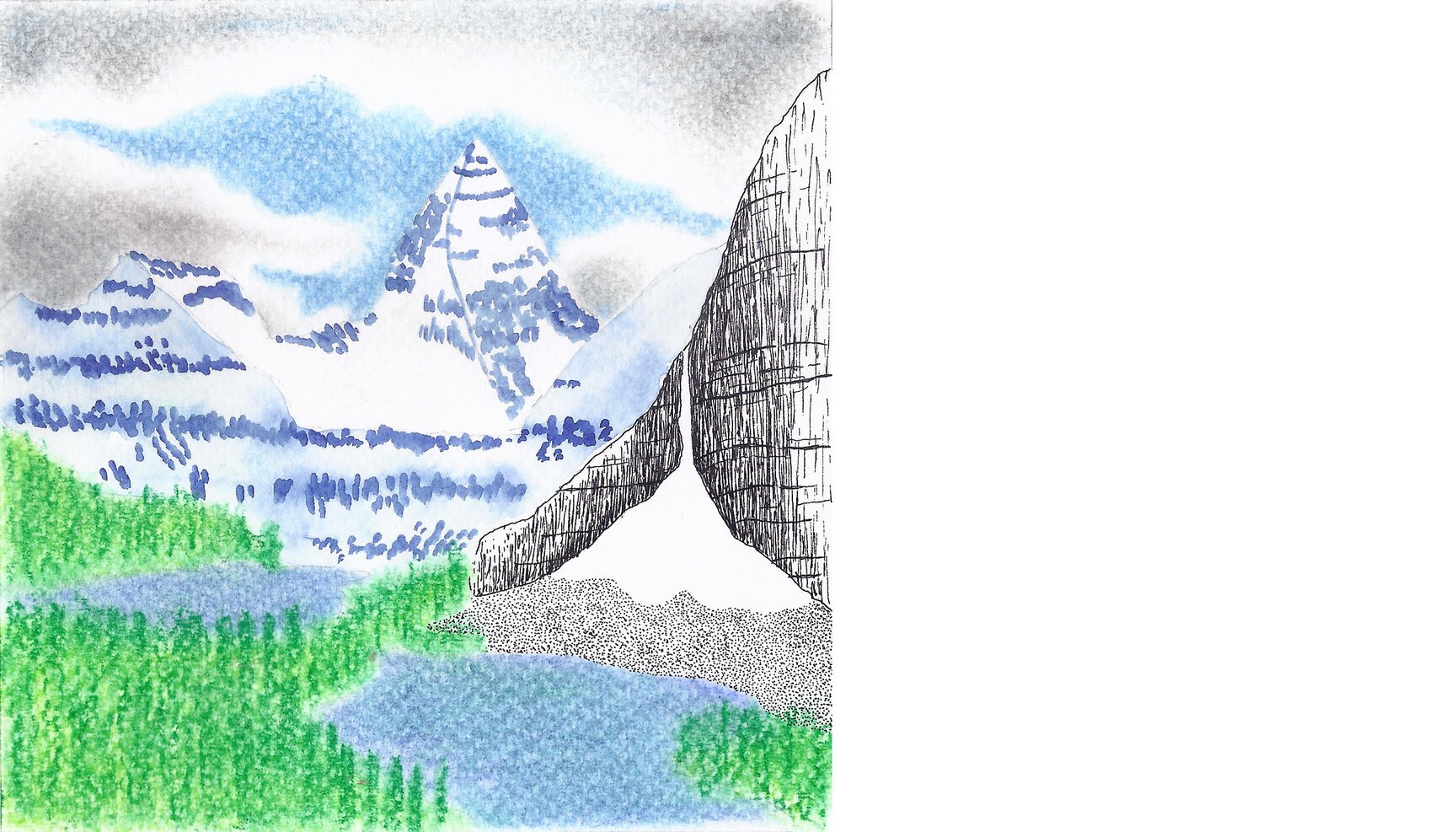
Day 19: Kailash Mountain (Tibet)
Day 19 looks at Kailash mountain, the “Precious Snow Mountain” in Tibet, seen rising beyond the deep blue waters of eerie Rakshastal at 30°50’33.49” N 81°13’05.10” E.
Rakshastal stands in stark contrast to its neighbour 4 kms away, lake Mansarovar, despite sharing a small river that connects the two. While the “lake of the demon” is regarded as ‘darkness’, the latter is considered ‘brightness’, the lake of the gods. The former holds salty water while the latter supports marine life through its fresh water.
Good and Evil, separate yet connected.
Day 20: Nako Lake (India)
Day 20 looks down at the little lake of Nako in Kinnaur district of Himachal Pradesh from 31°52’41.63” N 78°37’43.95” E.
Nako is a high altitude lake set above the Buddhist village by the same name. It is a small lake and you can never give it a single colour definition. At times it is azurely blue, others it is opaque in its turquoiseness and sometimes it just reflects everything that is around it. And lining it are beautiful willow and poplar trees, some of which turn into all shades of yellow in autumn, completely changing the landscape.
Day 21: Meru (India)
Day 21 looks at the Meru peak in Uttarakhand (India) from the snout of Meru Bamak glacier at 30˚54’44.42” N 79˚03’54.82” E.
Meru peak, located close to the famous Hindu pilgrimage site of Kedarnath, lies between the Shivling and Thalay Sagar peaks. The mountain has three peaks, highest being 6,660 mts. The one that we are intrigued by is the central and the smallest of the three peaks at 6,310 mts, called the Shark’s Fin. It is considered to be one of the hardest routes in the world.
Though the mountain’s highest peak was climbed long time back, Shark’s Fin route (the central peak was climbed in 2001 but avoiding the Shark’s Fin) was ascended only in 2011 by American climbers Conrad Anker (3rd attempt), Jimmy Chin and Renan Ozturk (2nd attempt for both). They have made a feature documentary on their tryst with the great mountain which came out in 2014. You can check it out at www.merufilm.com
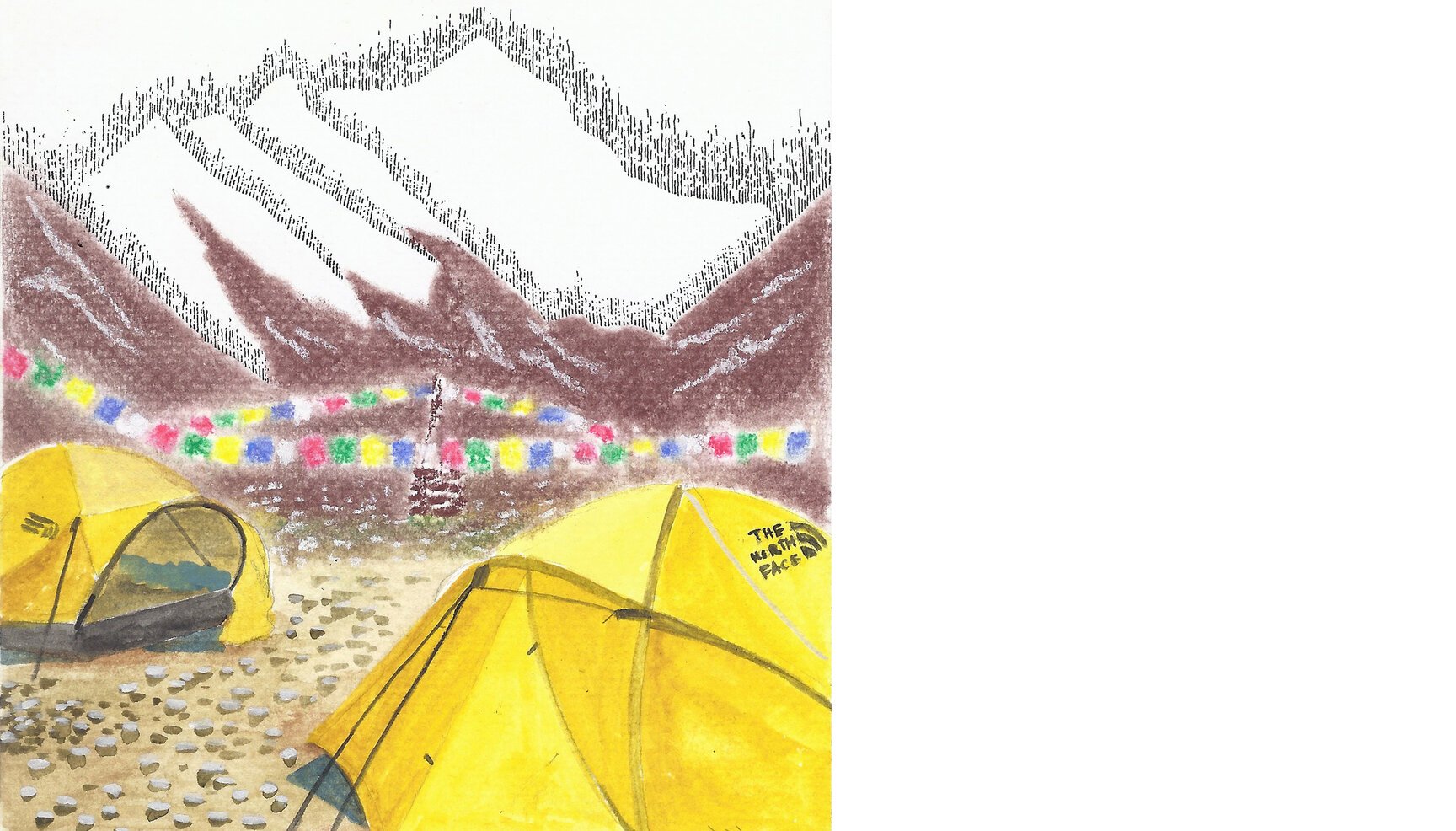
Day 22: Everest Base Camp (Nepal)
Day 22 looks far down at the Everest Base Camp (EBC) from the ice towers (seracs) of Khumbu Icefall (near camp 1) at 27°59’35.06” N 86°52’27.64” E.
Of all the climbing expeditions hit by the recent earthquake in Nepal, the avalanche to have struck EBC was the first one reported and acted upon. According to the Outside Magazine, the most significant avalanche (there wasn’t just one!) fell from a hanging glacier on the northern shoulder of the 7150 mts. high Pumori (far left corner), and this shoulder lies directly above the colourful tents of the EBC.
Uncannily, all those people who took refuge in their tents lost their lives while the ones who braced themselves against big rocks survived.
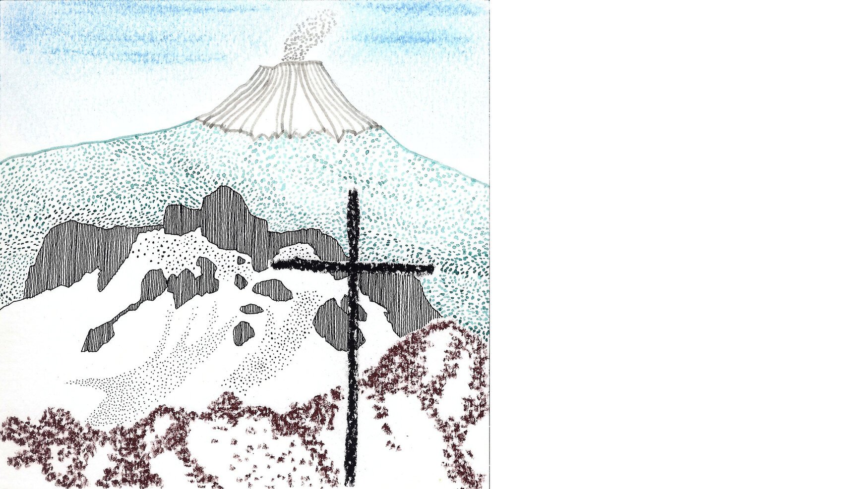
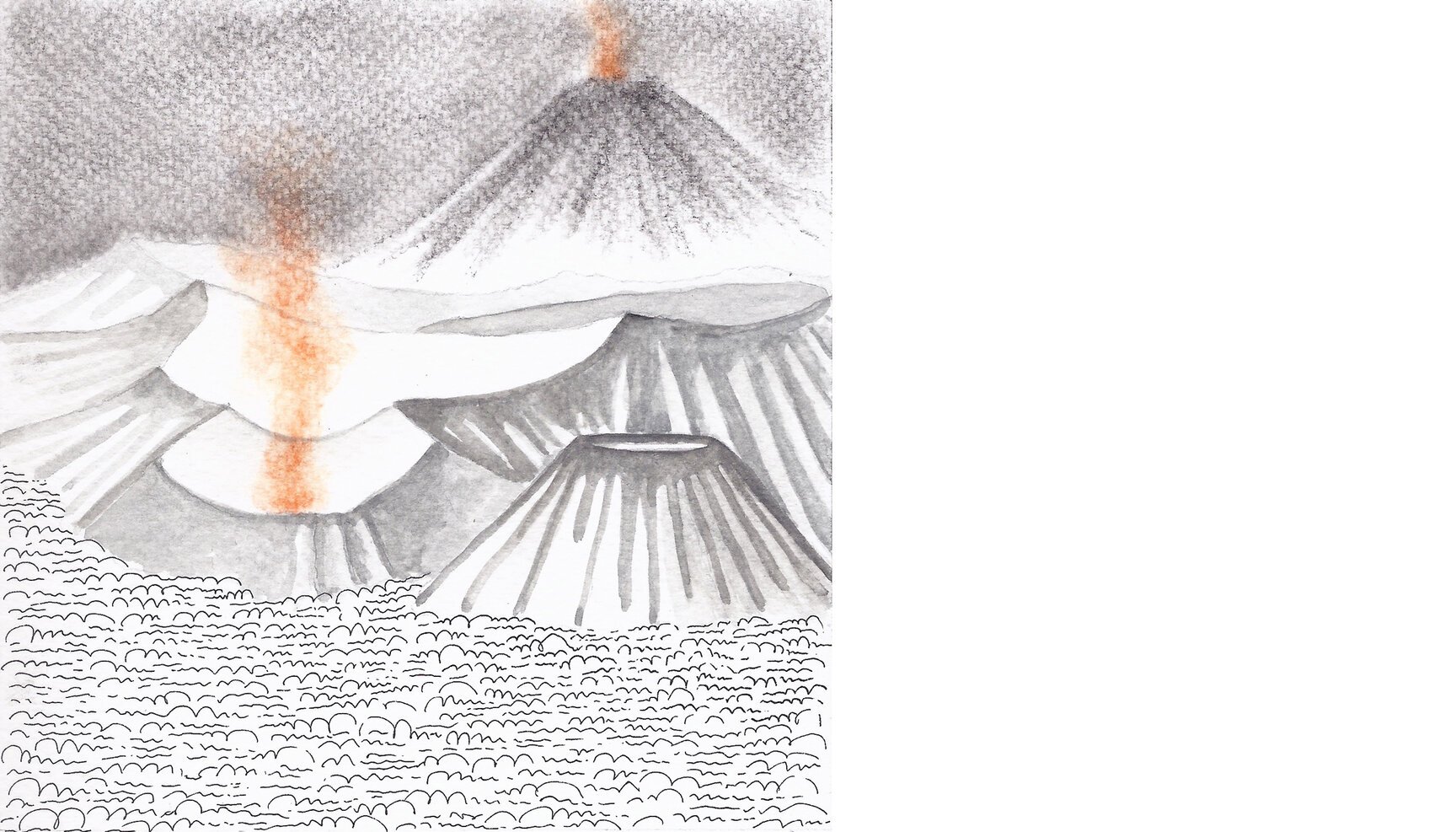
Day 23: Mount Rinjani (Indonesia)
Day 23 looks down at the second highest (3,726 metres) volcano in Indonesia from 8°22’59.68” S 116°24’09.41” E.
Loads of trivia follows :D
The volcano, an active one is called Mount Rinjani located on the island of Lombok. The top of the volcano is filled partially by the crater lake known as Segara Anak meaning Child of the Sea, named so due to the sea blue color of water.
A massive eruption of this volcano measuring 7 on VEI* (8 being termed apocalyptic) occured in the 13th century and may have been “the most powerful volcanic blast since humans learned to write”.
*VEI = Volcanic Explosivity Index
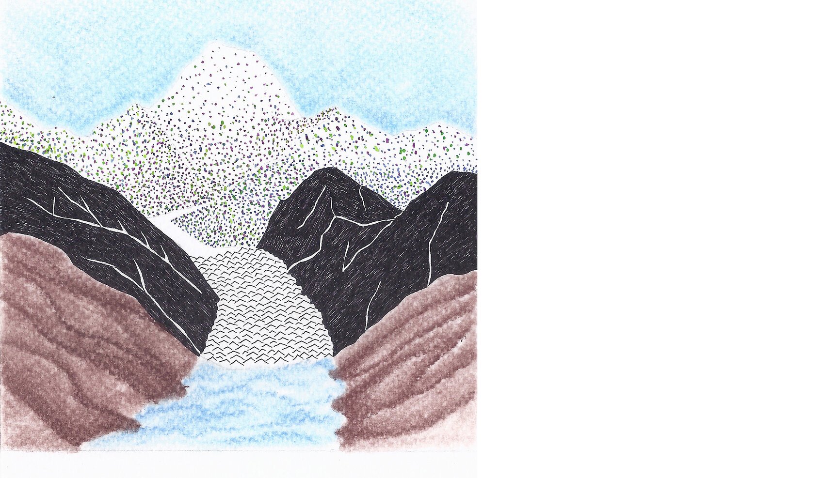
Day 24: Annapurna (Nepal)
Day 24 (100 days of mountains) looks at the Annapurna massif from the summit (28°41’46.64” N 83°29’36.11” E) of Dhaulagiri, the seventh highest mountain in the world. Annapurna, which is the world’s tenth highest mountain was first successfully climbed by a French team in 1950, which actually had plans to climb the Dhaulagiri. They changed their plans when they could not find a possible route up the mountain.
Both the mountains were also climbed in Winter for the first time by the great Polish climber Jerzy Kukuczka, the second person to climb all fourteen eight thousanders.
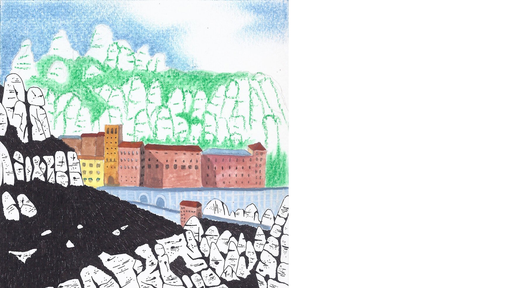
Day 25: Montserrat (Spain)
Day 25 looks at the multi-peaked mountain of Montserrat from 41°35’20.72” N 1°50’31.64” E, on one of its many hiking routes.
Located near Barcelona, Spain, the name Montserrat translates to “saw mountains” in Catalan language referring to its peculiar shape. Its highest peak reaches 1,236 mts.
The mountain is well known as the site of the Benedictine abbey, Santa Maria de Montserrat, which interestingly, still runs a publishing house, one of the oldest in the world with its first book published in 1499.
Day 26: Lofoten (Norway)
Day 26 marvels at the bowl of water in the lap of a hill or what is officially known as Reinevatnet lake from 67°55’39.96” N 13°04’32.44” E. Lying in the Norwegian archipelago of Lofoten, its name translates to “pure/clean”. Lofoten is known for a distinctive scenery with mountains and peaks, open sea and sheltered bays, beaches and untouched lands.
Despite being located north of the arctic circle, the archipelago experiences one of the world’s largest “elevated temperature” anomalies. The highest recorded temperature here has been 30°C or 87 °F in summers, owing to the warm currents of Gulf Stream and its extensions, the North Atlantic current and the Norwegian current. So if you are going there, do remember to pack your beachwear!
Day 27: Hkakabo Razi (Myanmar)
Day 27 looks towards the Hkakabo Razi (5,881m), the highest mountain in Myanmar, erstwhile Burma from 28°07’39.86” N 97°43’05.10” E. Recently, a team of American climbers unsuccessfully attempted to summit the peak and measure its true elevation as till today it remains a mystery. The original elevation of the peak was determined by an Indian surveyor in 1923. Only one person, a Japanese climber called Takashi Ozaki, is believed to have summited the peak in 1996.
The Burmese mountains are still extremely remote unlike the ones in Nepal or India and the team faced a logistical nightmare in simply reaching the base camp leaving the team worn not even before they actually started climbing. Read more here.
Myanmar or Burma as i have always known the country has so many times been a part of conversations while growing up as my grand dad went there for work. So reading about this expedition ignited my curiosity again. With all the geopolitical issues plaguing the country, Burma still remains a mystery. This country which is so close yet so far.
Day 28: Big Pinnacle or The Knob (USA)
Day 28 looks at the Big Pinnacle or The Knob from the tourist viewpoint on its younger brother, the Little Pinnacle at 36°20’24.38” N 80°28’40.21” W.
Lying in the US state of North Carolina, both these peaks are collectively called the Pilot Mountain. The mountain’s triangular slopes of trees lead to high and colourful bare rock walls of the Big Pinnacle which are further topped with trees giving it a unique look. The region’s earliest known inhabitants, the Saura Indians, called it “Jomeokee” meaning the ‘great guide’, owing to its distinctive shape (prominence of approximately 430 mts.) which is visible from far away and could have been used as a navigational feature.
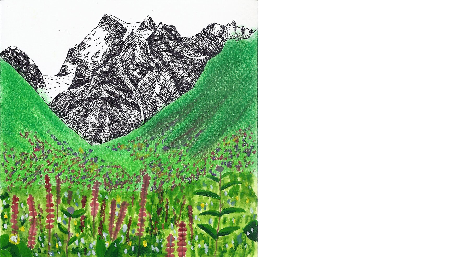
Day 29: Valley of Flowers (India)
Day 29 takes a wide view of the famed Valley of Flowers National Park (3352 to 3658 meters) located in the Bhyundar valley of Uttarakhand, India from 30°43’27.12” N 79°35’24.81” E. This is a high-altitude Himalayan valley that has long been acknowledged for its immense beauty and diversity of endemic alpine flora that blooms all over the meadows carpeting the valley.
A little tale about its accidental discovery goes something like this: In 1931, Frank S. Smythe,Eric Shipton and R.L. Holdsworth, all British mountaineers, lost their way while returning from a successful expedition to Mt. Kamet and happened upon the valley, which was full of flowers. They were attracted to the beauty of the area and named it the “Valley of Flowers”
The valley was declared a national park in 1982 and is a UNESCO World Heritage Site since 2004. The park is about 8 km long and 2 km wide. It is at its brightest and colourful best during the monsoon months of July and August.
Day 30: Wanaka Lake (New Zealand)
Day 30 looks at the Wanaka lake from atop Mount Roy (44°40’24.72” S 169°03’00.83” E) in the Otago region of the South Island of New Zealand. The name Wanaka comes from the Maori word Oanaka (‘The place of Anaka’, a local tribal chief). It lies in the heart of the Otago lakes and is surrounded by mountains except towards the south where the town of Wanaka is. The town was originally settled during the gold rush of the 19th century but now is popular for adventure sports and as the gateway to the Mt. Aspiring National Park.
This artwork is inspired by the beautiful photograph of the same view by photographer Chris Burkard. You have to go and see his photograph.
Day 31: Chimborazo (Ecuador)
No, that ain’t Mount Fuji. Day 31 looks disbelievingly at the HIGHEST mountain in the world, Chimborazo in Andes, from 1°29’53.82” S 78°44’14.70” W.
Highest, not when measured from the surface of the earth but from its centre. Because the earth’s diameter along the equator is 42.72 kms more than that from pole to pole (phenomenon known as equatorial bulge), Chimborazo’s location (almost on the equator) makes it the farthest point from the earth’s centre!
Seen from the grasslands and fields of the settlement of Urbina, Ecuador, the 6267 mts. high mountain is an inactive volcano believed to have last erupted in 550 AD.
Day 32: Mount Kirkjufell (Iceland)
Day 32 looks from 64°55’21.30” N 23°17’36.80” W at Mount Kirkjufell, our first venture into Iceland, the place of dream landscapes.
Kirkjufell is a mountain in Grundarfjörður (a small town with a population of 900!) that peaks at 463 metres and happens to be the most photographed mountain in Iceland. Its isolated position jutting out into the sea (and sky) makes it a unique attraction for tourists and photographers alike.
Surrounded by beaches, Kirkjufell has a lovely walking trail around it that offers amazing views and takes 3-4 hours. The more challenging climb up to the top is recommended only for experienced trekkers.
The word ‘Fell’ which often succeeds names of mountains in Scandinavia, Iceland etc. comes from Old Norse referring to ‘mountains rising above the alpine tree line’.
It’s a delight how many new and exciting things we are learning everyday through this project. Drawing sights we may never see with our eyes and learning words that have roots in centuries past.
And Iceland, we will be back!
Day 33: Dunagiri (India)
Day 33 looks towards the peak Dunagiri from Jhandidhaar (30°29’40.61” N 79°45’55.96” E) a ridge top on the Nandadevi sanctuary trek.
On the other side of the mountain, there is a portion that seems to have either caved in our carved out or something. The local legend has it that when Hanuman was flying to Dunagiri to bring back the life giving herb ‘Sanjeevni’ to Ram to save his brother Lakshman, the demon king Ravan sent his soldiers to burn the whole mountain so that Hanuman couldn’t get what he wanted. But Hanuman being the son of the king of wind, simply carved a block out of the mountain and flew back to Lanka extinguishing the fire (by the speed of wind) in the process and getting the magical herb to its destination.
The mountain rises majestically to 7066m and has some really prominent neighbours like the Nandadevi, Mana, Kamet, Trishul and so on.
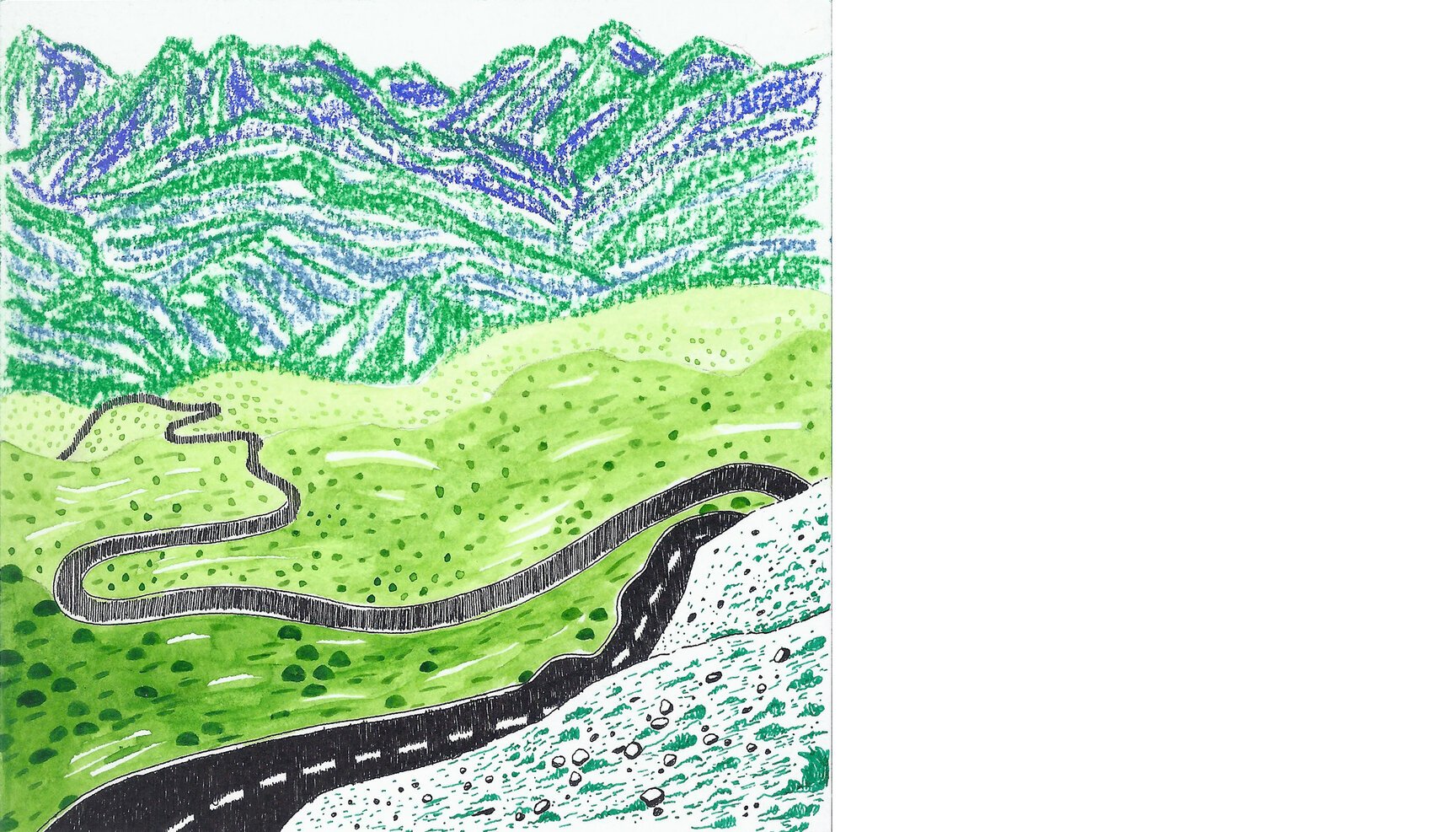
Day 34: Hochtor Pass (Austria)
Day 34 looks at the winding Grossglockner High Alpine Road from Hochtor pass, 47°04’54.52” N 12°50’31.31” E at 2,504 mts.
Built initially as a scenic route and opened to the public in 1935, the road has since been put to use for a number of purposes, from vintage car rallies to bike and cycle races to marathons and even automobile testing on its steeper sections.
The road is named after Austria’s highest mountain, Grossglockner.
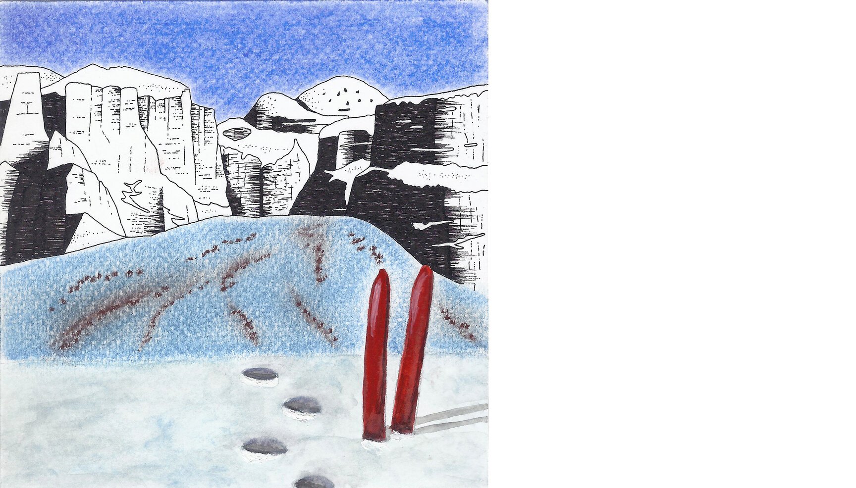
Day 35: Sella Group (Italy)
Day 35 looks up at the breathtaking alps of Italy, the Dolomites from the snow bound lower slopes of Col Rodella at 46°29’47.90” N 11°45’06.31” E.
Sella group is a plateau-shaped massif that houses numerous peaks, with the highest of them touching 3,151 mts. This region is a heaven for adventure enthusiasts. One can ski around the entire massif in winter, while in summer, there is the option to cycle, run or drive around it through trails stretching over 42 kms and a network of four passes; Campolongo, Pordoi, Sella and Gardena. For people who don’t want to drop a sweat, there is a funicular to one of the summits.
Day 36: Popocatépetl (Mexico)
Day 36 watches Mexico’s second highest mountain, Popocatépetl (5,426 m) from the southern end (19°09’41.60” N 98°38’11.86” W) of the third highest mountain, Iztaccíhuatl (5,230 m). Both are volcanic mountains, the former being an active volcano and the latter dormant. Popocatépetl is Mexico’s most active volcano that last erupted on March 22, 2015. Along with Pico de Orizaba (5,636 m), also a volcano and the highest mountain in Mexico and Iztaccíhuatl, Popocatépetl had glacial formations on its slopes but due to warmer temperatures and predominantly due to increased volcanic activity the latter has lost all of its glaciers.
As per Aztec mythology, Iztaccíhuatl, a princess, fell in love with one of her father’s warriors, Popocatépetl. Her father sent Popocatépetl to war in Oaxaca, promising Iztaccíhuatl as his wife when he returned. Later, Iztaccíhuatl was falsely informed of Popocatépetl death in battle, believing which she died of grief. When Popocatépetl returned to find his love dead, he took her body to a spot outside Tenochtitlan and kneeled by her grave. It is said that the gods covered them with snow and changed them into mountains. Iztaccíhuatl’s mountain is called “White Woman” because it resembles a woman lying on her back, and is often covered with snow while Popocatépetl became an angry active volcano at the loss of his beloved.
Day 37: Mir Samir (Afghanistan)
Day 37 looks at Mir Samir from Chamar pass at 35°35’05.58” N 70°13’26.42” E.
We trace our steps back to 1956 to follow the journey of one Eric Newby to Nuristan, an eastern province of Afghanistan. Initially making a living in the London haute-couture trade and bored to death of it, it was a telegram sent by his friend Hugh Carless which paved way for a legendary journey to the mountains of Hindu Kush, chronicled in the one of the greatest travel classics - A short walk in the Hindu Kush.
What did the telegram say?
“Can you travel nuristan june?” Who wouldn’t want a friend who would say ‘yes’ to a message as cryptic as this!
The eventual aim of their journey? To climb the unclimbed peak of Mir Samir (5,809 mts.), seen here from Chamar pass, on their return journey after they failed to summit despite numerous attempts. Well, they couldn’t be blamed, neither had done any climbing before!
Day 38: Mount McKinley (USA)
Day 38 looks at Mount McKinley with Wonder Lake in the foreground from 63°29’10.92” N 150°52’19.30” W.
Mt. McKinley, also known as Denali, is the highest mountain peak in North America, with an elevation of 6,168 m. Since McKinley sits directly atop a plain with elevations from 300 mts. to 900 mts. so when measured from base to peak, it is the world’s tallest mountain on land.
It is part of the Alaska Range and the centerpiece of Denali National Park.
Day 39: Auzangate Mountain (Peru)
Day 39 looks up at the Auzangate mountain (6,384 m) in Peru from one of the many glacial lakes (13°48’22.91” S 71°16’50.92” W) around it. The mountain is part of the Willkanuta range in the Peruvian Andes and also part of the Inca mythology. Every year the Quyllur Rit’i (Quechua for “star snow”) festival attracts thousands of Quechua pilgrims and is celebrated about 20 km north of the Auzangate at the mountain Qullqipunku. It takes place a week before the Corpus Christi feast.
Apart from having four major geological features which give the landscape its unique colours, the region is also inhabited by lama and alpaca herding communities, one of the few remaining pastoralist societies in the world. The area sees a lot of tourism and one of the high mountain trails taken by the local communities is a popular trekking route called ‘the road of the Apu Auzangate’.
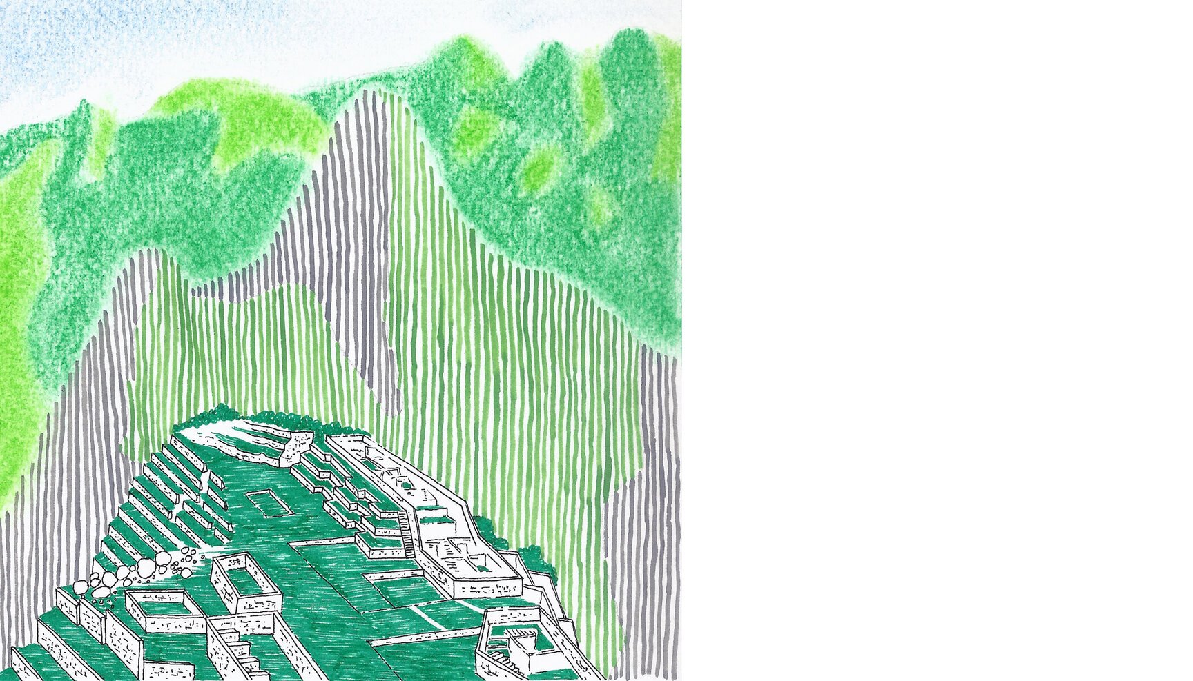
Day 40: Machu Picchu (Peru)
Day 40 looks at the ancient city of Incas, Machu Picchu, from 13°09’57.03” S 72°32’41.19” W.
Meaning ‘old peak’ in Quechua, the 15th century city sits in a saddle between the two mountains Machu Picchu and Huayna Picchu at the height of 2,430 mts.
There is loads to read on this UNESCO world heritage site in Peru, but the most interesting bit? The weather here is divided in two seasons; wet and dry, as simple as that! Though the bulk of annual rainfall happens between October and April, it is safe to assume that it can rain here any time.
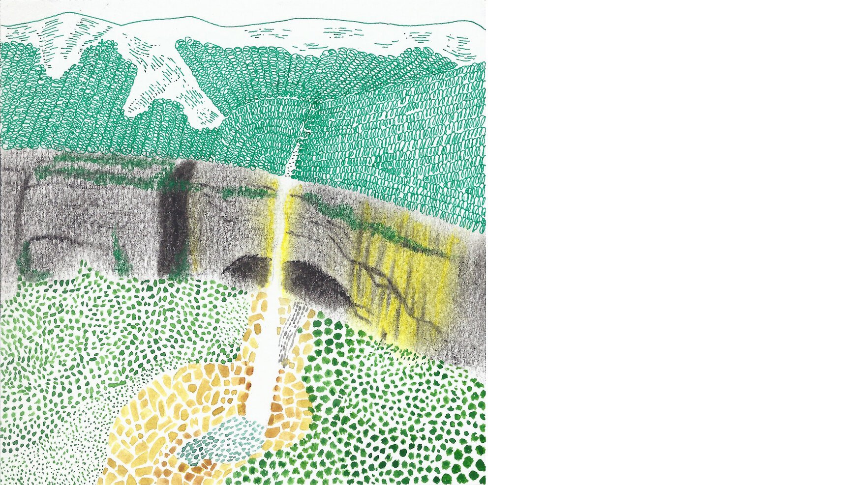
Day 41: Nohkalikai Falls (India)
Day 41 gazes at the waterfall of Nohkalikai in Cherrapunji from 25°16’11.64” N 91°41’20.86” E.
This waterfall (falling from a height of 340m in one plunge) seems gentle but comes with a horrific and sad story. The name of the falls in Khasi language meaning “Jump of Ka Likai”. The legend is about a local woman ‘Likai’ who jumped off the cliff next to the falls in a mix of anger & grief after finding out that she had been fed her own infant daughter, by her husband.
Day 42: The Palisades (USA)
Day 42 marvels at the Palisades, which are a group of peaks in the central part of the Sierra Nevada in California, USA from the edge of one of the many lakes surrounding the range (37°06’11.64” N 118°33’13.00” W). The range covers several of the 14,000 ft peaks within the state of California.
The Palisades were part of the 12 fourteeners of Cedar Wright and Alex Honnold’s first Sufferfest connecting all the fourteeners of California. They only used human-powered transportation between trailheads and tried to free-solo as many technical climbs as possible. The project started from Mount Shasta and ended at Mount Langley.
As Wright put it, the highlight for the pair included the Palisade Traverse, which climbs a long ridge between Mount Sill and the Thunderbolt Peak comprising five fourteeners in the process, as well as getting to bike down steep mountain passes after each climb.
Day 43: Panchchuli Peaks (India)
Day 43 looks at the Panchchuli peaks from 30°04’48.39” N 80°17’49.92” E, near Munsiyari.
Located in Kumaon region of Uttarakhand (India), the five peaks of Panchchuli have altitudes ranging from 6,334 mts. to 6,904 mts. The highest of these, Panchchuli II (first from left) was first scaled by an Indo-Tibetan Border Police expedition in 1973.
Panchchuli word is derived from Pandava’s “five chulis (cooking hearths)” and it’s here, so believed, they cooked their last meal before leaving the earth for their heavenly abode. And this is what’s massively confusing. For it is believed they climbed the Swargarohini glacier to enter heaven, a glacier that lies 200 kms (as the crow flies) north-west!
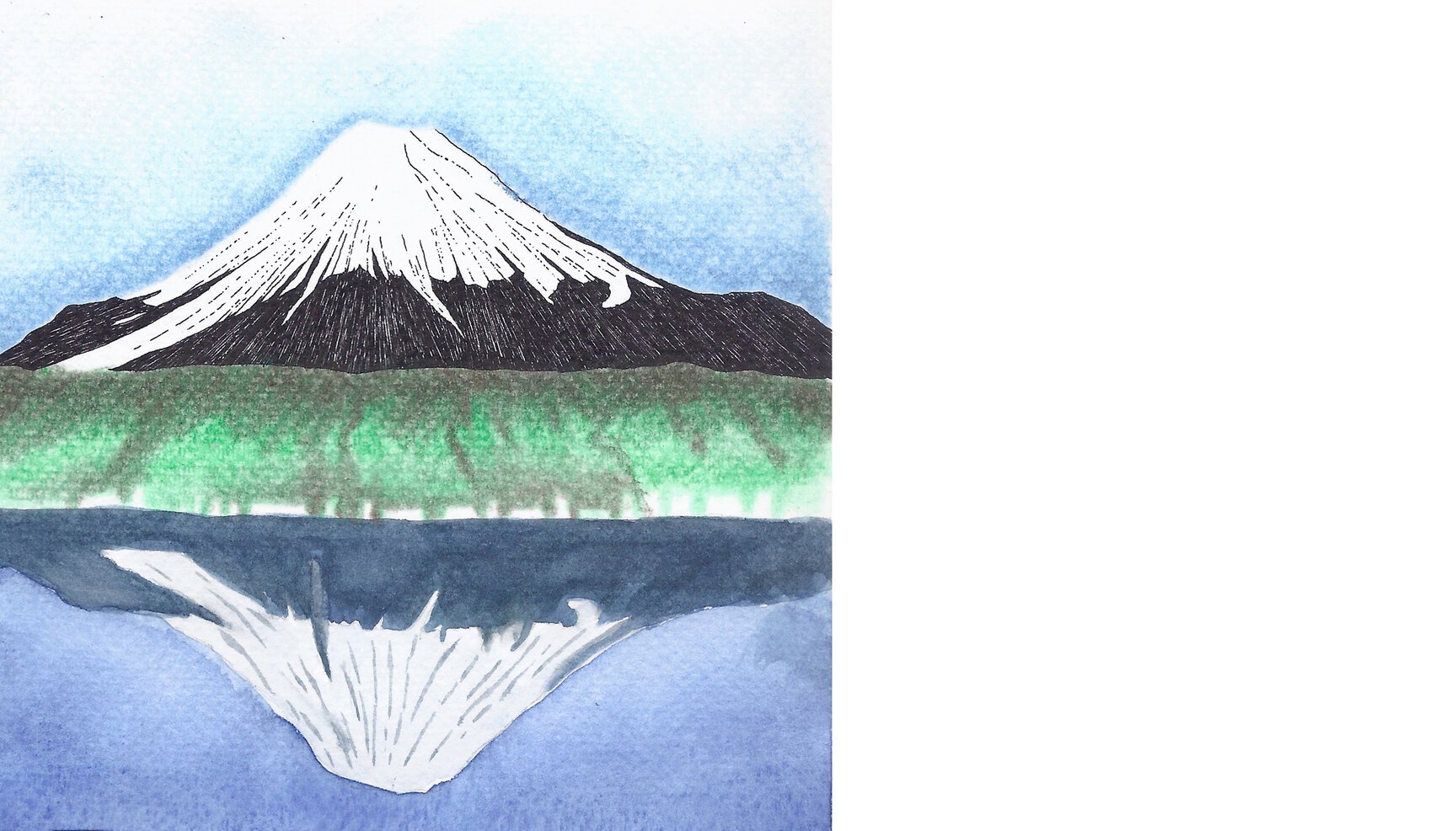
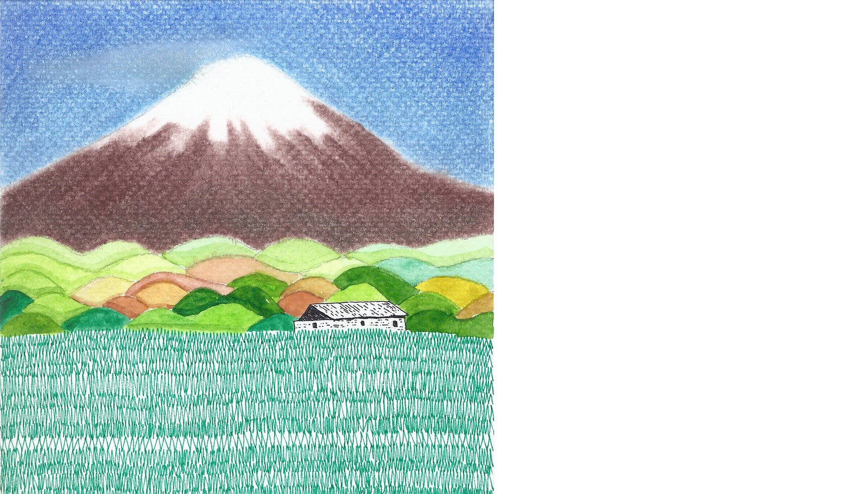
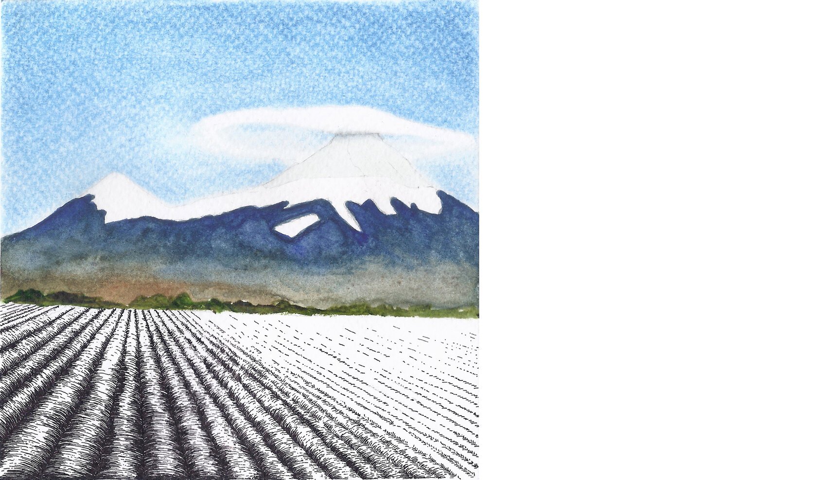
Day 44: Mount Fuji (Japan)
Day 44 reflects at the beautiful Mount Fuji from 35°25’23.42” N 138°52’53.29” E, with Lake Yamanaka in the foreground.
Fuji (3,776 m) is that perfect symmetric-triangular mountain we all love drawing which remains snow-capped for several months a year. The lake of Yamanaka is one of the five located in the area called Fuji Five Lakes, at the base ofMount Fuji.
Day 45: Shipton Spire (Pakistan)
Day 45 stares in bewilderment at the otherworldly-looking Shipton Spire (6,004 m approx.) from the glacier at the base (35°46’01.37” N 76°07’47.71” E). The Shipton Spire is a near vertical peak discovered by Eric Shipton, a distinguished British mountaineer, during his trek to China through the Karakoram in 1938 and mentioned in his book ‘The Six Mountain Travels’.
The Shipton Spire is considered by some as the El Capitan of the Karakoram due to the ever increasing number of climbers wanting to summit it.
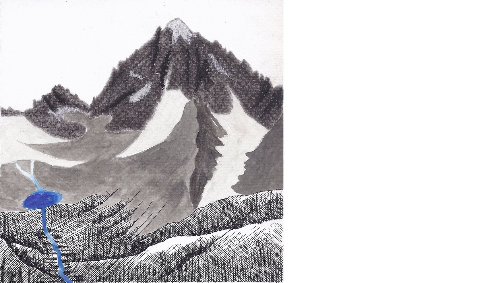
Day 46: Nun-Kun (India)
Day 46 looks at the Himalayan pair of Nun and Kun peaks from 34°03’59.84” N 75°57’28.70” E.
Located in the Suru valley near Kargil (Jammu and Kashmir, India), Nun stands at 7,135 mts. while Kun is a few feet lower at 7,077 mts. Nun (right background) is a lofty peak with a heavy build and is snow covered all year round. Separated by a glacial plateau 4 kms away (dark blue here), Kun (left background) is slimmer with an exposed rock surface and very little snow.
On our journey to Zanskar, it was a surreal experience to see Nun towering above the nearby mountains from afar, so much so that it almost seemed fake. And since then we have been smitten with these beauties, possibly also because of their short and cute names!
Day 47: Pedraforca (Spain)
Day 47 looks at Pedraforca (2,506 m), a mountain of thePyrenees of Spain from 42°13’55.55” N 1°45’42.38” E
Two interesting things emerged during our research on this mountain. One is a legend that the mountain is traditionally considered a place where Catalan witches would gather, dance and sing. Secondly, the mountain’s unique form brings to memory the tower of Mordor from The Lord of the Rings. The tower which housed the Eye of Sauron that kept watch over Middle-earth from its vantage point.
Notwithstanding both connections are that of an evil nature, its notoriety (connection to witches) has made it a popular destination for hikers and rock-climbers.
Day 48: Mount Damavand (Iran)
Day 48 looks at Mount Damavand, a stratovolcano which is the highest peak in Iran and the Middle East as well as the highest volcano in Asia from a little ahead (35°51’04.37” N 52°04’52.39” E) of the town of Polour. The mountain is very close to the southern edge of the Caspian Sea and has several hot springs on the flanks and at the base.
The mountain is also an important part of the Persian and Iranian folklore, mythology and literature. In Zoroastrian texts and mythology, a three-headed dragon called Aži Dahāka was chained within Mount Damavand to remain there until the end of the world.
Day 49: Mount Elbrus (Russia)
Day 49 looks at Mount Elbrus from the Russian hinterland at 43°36’50.39” N 42°35’18.51” E.
Having two summits, both being dormant volcanic domes, Elbrus reaches a height of 5642 mts. and is the highest mountain in Europe. Located in the Caucasus mountains and near the border between Russia and Georgia, it was first ascended in 1829 (lower summit) and 1874 (higher summit).
At about 4200 mts. there is an old Pruitt Hut on the way to the summit where mountaineers camp before their summit bid. Though not in good shape due to a fire that almost brought it down, its outhouse (dry toilet) survived the fire and is still used by climbers. Anchored to a big rock and hanging over a scary icy abyss, it is notorious for being awarded the ‘world’s nastiest outhouse’ by Outside Magazine in an article in 1993.
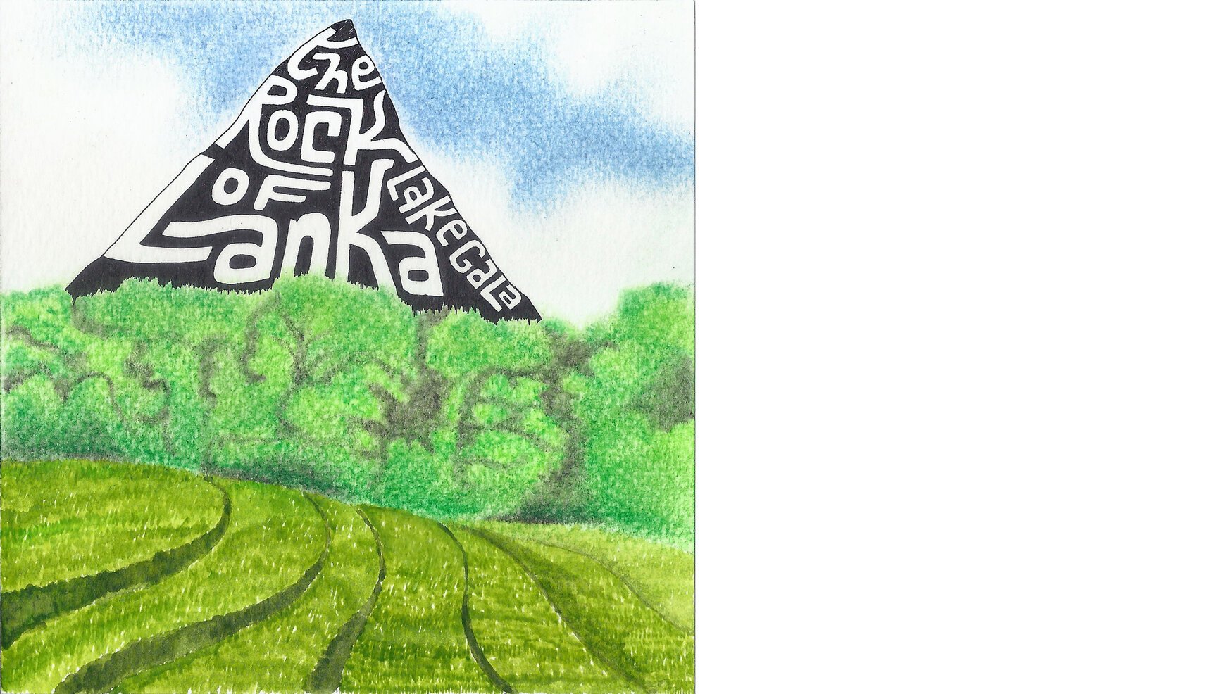
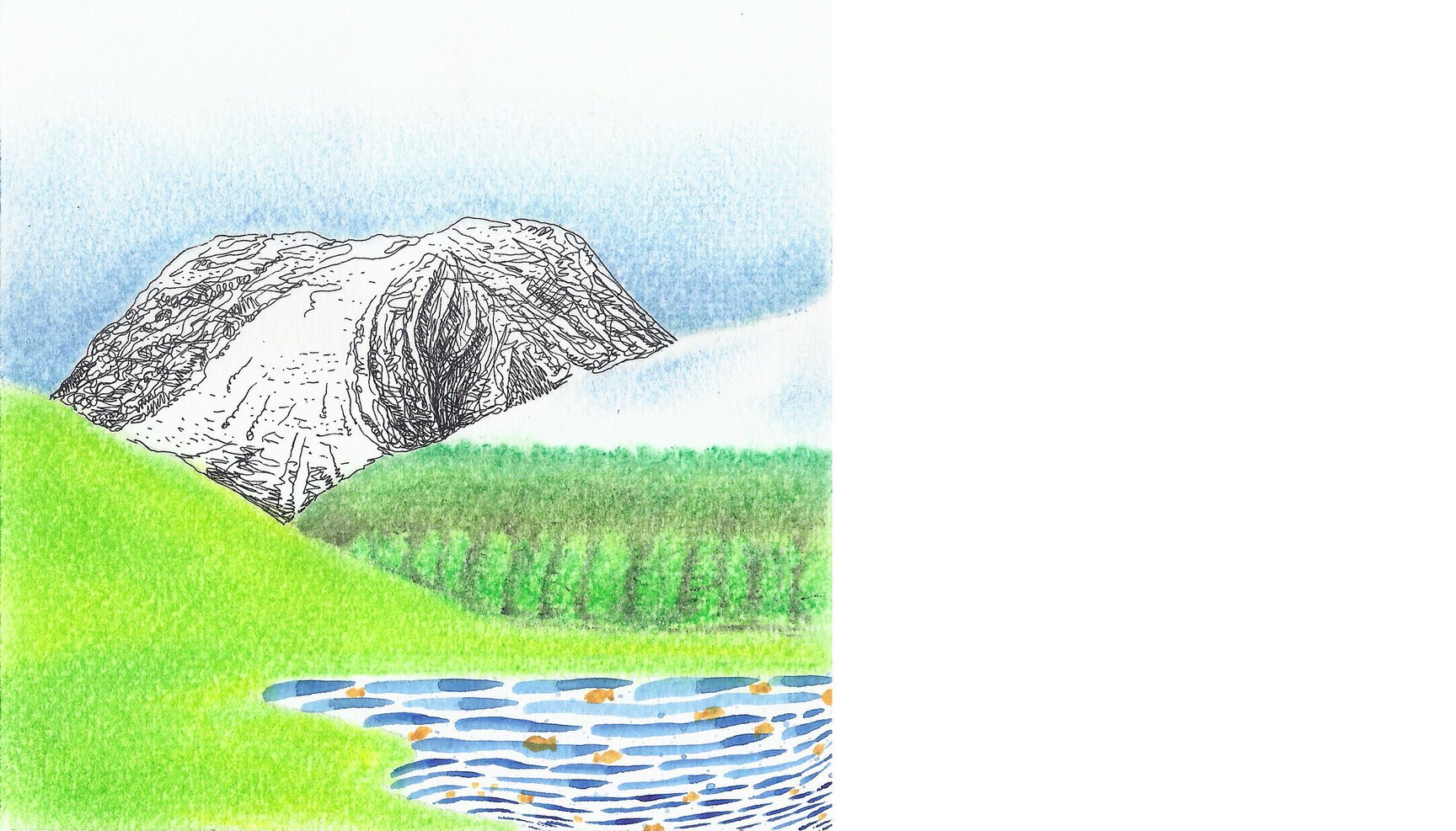
Day 50: Lakegala (Sri Lanka)
Today we look across terraced paddy fields up at Lakegala towering over a patch of forest from 7°26’33.76” N 80°50’38.18” E.
Lakegala which means “The Rock of Lanka” in Sinhalese is a giant monolith-like projection with an almost 90 degree angle.
A number of legends, all related to Ravana (from Ramayana) are linked with Lakegala. A few of those are that “Ravana used the rock as a sundial to calculate the time in his kingdom” or that “there was a herbal garden on top of Lakegala” or most awesomely that ” this is the place from where Ravana flew his aeroplane Dhadu Monara, which he used to capture Sita from India”.
The rock is geographically located in the centre of Sri Lanka in the village of Meemure, and on a clear day one can see all the way to the eastern coast from the peak of Lakegala. It is possible to climb to the top without any rock-climbing experience but the last 100 metres are supposedly a tough 90-degree scramble.
Sidenote: Google Earth seems to be quite a liar when it comes to actual shapes and structures of some mountains. For instance this sharp pointy monolith looks like half a boiled potato on google earth.
Day 51: Mount St. Helens (USA)
Day 51 looks at Mount St. Helens with the Spirit Lake before it from atop Mount Margaret (46°18’41.95” N 122°08’02.79” W).
Mount St. Helens is an active stratovolcano known for its catastrophic eruption on May 18, 1980, the deadliest and most economically destructive volcanic event in the history of the United States of America. The eruption was so devastating that apart from the human casualties and economic loss, the mountain’s summit itself was reduced in elevation from 2,950 m to 2,549 m with a 1.6 km wide horseshoe-shaped crater in its place. The Spirit lake, just below the mountain, has debris from the eruption still floating on its surface.
David A. Johnston, a 30 year old volcanologist, stationed on the nearby Coldwater Ridge radioed his last famous words “Vancouver! Vancouver! This is it!” moments before the eruption hit him. His body was never found.
Day 52: Angel Falls (Venezuela)
Day 52 looks at the world’s highest water fall, Angel Falls from the banks of Churun river at 5°58’44.13” N 62°31’03.04” W.
Located in Venezuela, it falls off the Auyantepui mountain in Canaima National Park, a UNESCO World Heritage site. A ‘Tepui’ is a table-top mountain found in the highlands of South America. It means “house of the gods” in Pemon, but interestingly Auyantepui translates to “devil’s house”. It’s a wonder what resides at the top or inside this mountain that one needed to completely reverse the meaning!
Day 53: Ben Nevis (Scotland)
Day 53 gazes at British Isle’s highest mountain, Ben Nevis from the banks of Loch Lundavra at 56°44’36.10” N 5°08’20.50” W.
Ben Nevis (1,344 metres) is now all that remains of the imploded inner dome of the volcano that erupted 350 million years ago. Its form has been extensively shaped by glaciation. The mountain in located in the Scottish Highlands, close to the town of Fort William.
Over 100,000 people climb Ben Nevis every year making it an important tourist attraction in Scotland. Which takes me back to my trip to Scotland from 6 years: when we were checking out of the BnB our host asked us if we were planning on ‘climbing’ Ben Nevis. At that time, that question completely messed with my brain wondering how in the world I was going to climb the highest mountain of that country. We eventually didn’t climb it as we had to go some place else, but now, when I think of a mountain that is less than 1400 m high, I wouldn’t think thrice before wanting to walk it up!
Day 54: Mount Khumbila (Nepal)
Day 54 looks at the majestic play of light and shade on Mount Khumbila (5,761 m), a sacred peak in the Khumbu region of Eastern Nepal within the boundaries of the Sagarmatha National Park. The name roughly translates as “God of Khumbu” and is considered to be a powerful old Buddhist God.
Though this peak has never been climbed and is considered too sacred to be climbed, Nepal has recently (2014), as pointed out by @americanalpine, made all the peaks below 5,800 m open to climbing with no permit or bureaucratic procedures required.
Nepal has innumerable beautiful 5,800 m peaks and only last year a British team made it’s first ascent of Lumba Sumba, a peak somewhere between Makalu and Kanchenjunga.
One of the ways to help Nepal through the Earthquake devastation, as suggested by several climbers is to go travelling/climbing there.
Our sketch is inspired by a beautiful photo by Michal Petro.
Day 55: Aogashima Island (Japan)
Day 55 looks at the small (3.5 km by 2.5 km) tropical volcanic island of Aogashima from one its ridges (420 mts) at 32°27’35.71” N 139°45’42.72” E.
Located in the Philippine sea, and a part of Japan despite being some 360 kms away from Tokyo, the island has a very unique shape. Imagine a lava cake whose top has come off to reveal another, smaller lava cake placed inside it and whose top too has been scooped out.
Even though it last erupted in 1780s, it still holds an active class-C status. It has no real harbour, so one can ‘hardly’ reach by boat, leaving a helicopter-a-day as the only practical option. And still some 200 humans inhabit the island!
Day 56: Chief Mountain (USA)
Day 56 stares at the sudden outcrop of rock from the ground, called Chief Mountain, from 48°58’19.89” N 113°34’33.17” W
Chief Mountain, located in the US state of Montana rises to an altitude of 2,770 m out of which the top 1,500 m rise too rapidly, giving the mountain its unique shape.
It has been a sacred mountain to Native American tribes for hundreds of years. Natives from all over North America travel to the base of the mountain for sweet grass ceremonies, placing of prayer flags and other religious rites.
And it goes/went by a variety of names : Nínaiistáko, Kings Peak,Tower Mountain, Great Chief, Hũga Baha (″Chief Hill″) among others.
Day 57: Grand Teton (USA)
Day 57 looks at the Grand Teton from the Jackson Hole valley (43°39’42.83” N 110°41’10.60” W). Though it looks absolutely beautiful in several of the photographs that i have seen of it, the funny bit is that the origin of the name ‘Grand Teton’, though disputed, is commonly believed to be ‘large teat’ in French. It was named such by either French-Canadian or Iroquois members of an expedition led by Donald McKenzie of the North West Company.
Most of the views that one gets to see (in pictures) of the Grand Teton, it looks nothing like a boob but more like a majestic dragon’s back. It would be interesting to see and know how it was thought to look like it’s name.
However, there are historians who disagree and claim that the mountain was named after the Teton Sioux tribe of Native Americans.
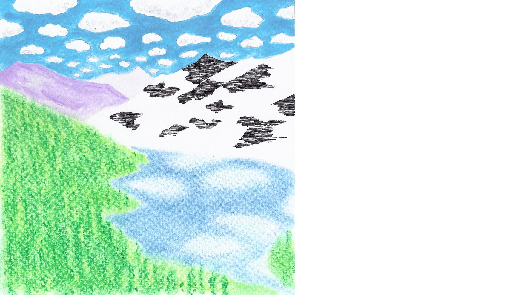
Day 58: Gurudongmar Lake (India)
Day 58 looks at the second highest lake of India, Gurudongmar, from 28°02’07.78” N 88°42’48.59” E.
5,243 or 5,430 mts high (varying accounts on the internet), this freshwater glacial lake lies in the remote northern part of the state of Sikkim. Legend has it that the lake used to remain frozen throughout the year making it difficult for people to use it in winters (what would anyone be doing at this altitude in winters I can’t be sure). On his return journey from Tibet to India, when Guru Padmasambhava passed it, he was apprised of the issue. He touched a portion of the lake, and that part hasn’t frozen since, not even in winters. And so the water is considered sacred by the Buddhists as well as Hindus.
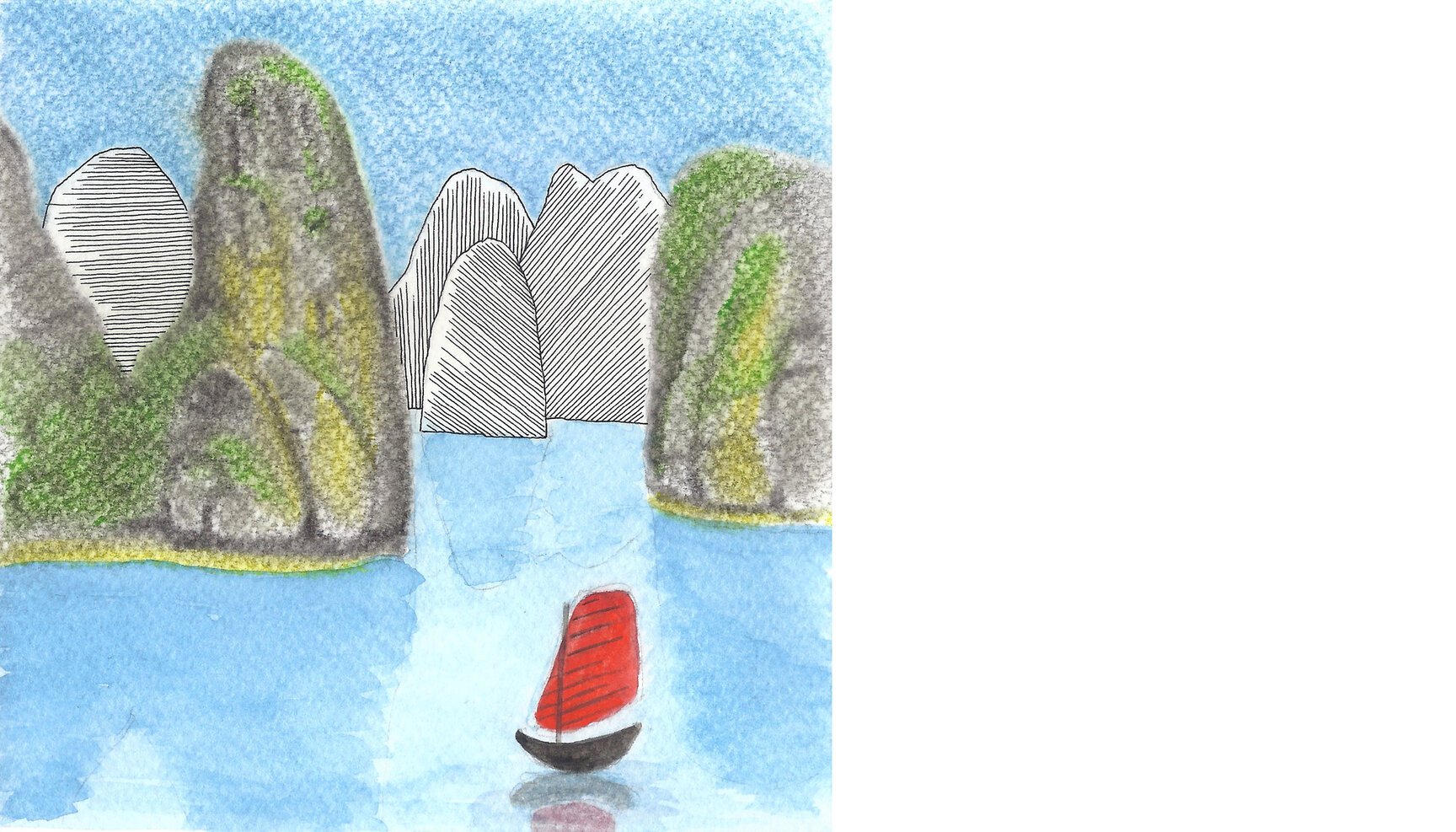
Day 59: Ha Long Bay (Thailand)
Day 59 looks at Ha Long Bay located in the Gulf of Tonkin, from 20°50’10.08” N 107°09’44.90” E.
Ha Long Bay includes some 1,600 islands and islets, forming a spectacular seascape of limestone pillars. Because of their precipitous nature, most of the islands are uninhabited and unaffected by a human presence (thankfully). But then again, when humans can’t conquer the land they will spread out in the water around. Given its wondrous natural beauty HLB is quite a famous tourist destination owing to which there are boats of all sizes floating about in the bay.
Halong translates as ‘where the dragon descends into the sea’, and legend claims the islands of Halong Bay were created by a great dragon from the mountains. As it charged towards the coast, its flailing tail gouged out valleys and crevasses. When it finally plunged into the sea, the area filled with water, leaving only the pinnacles visible.
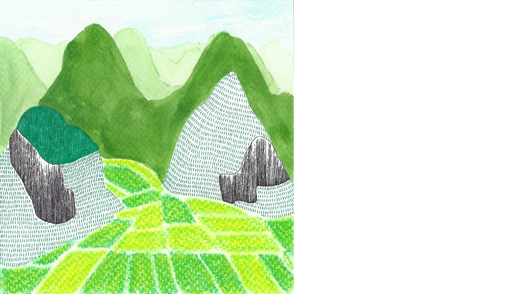
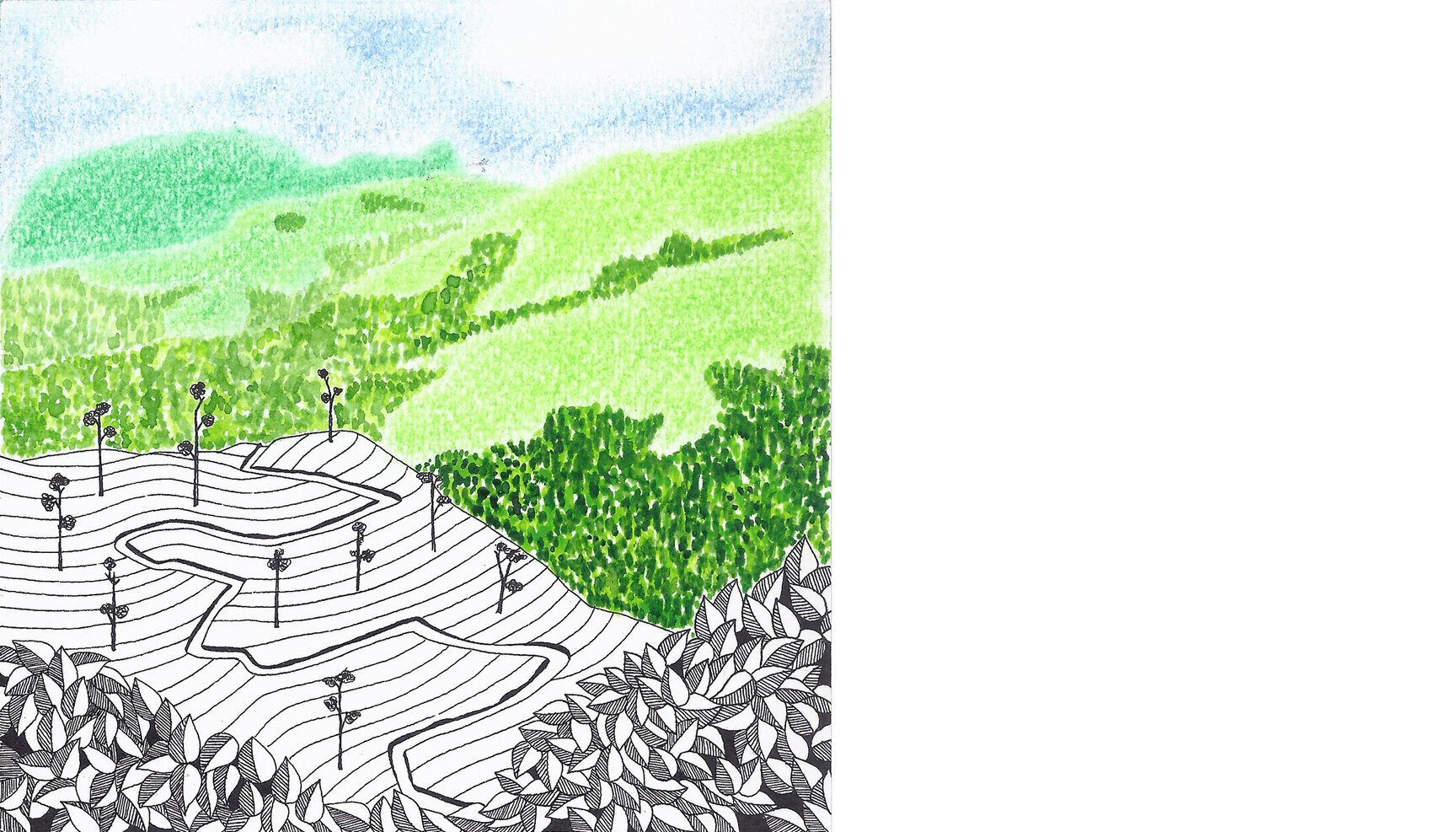
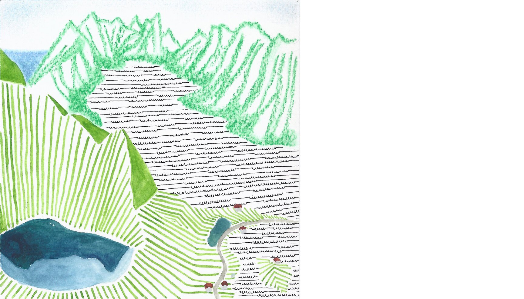
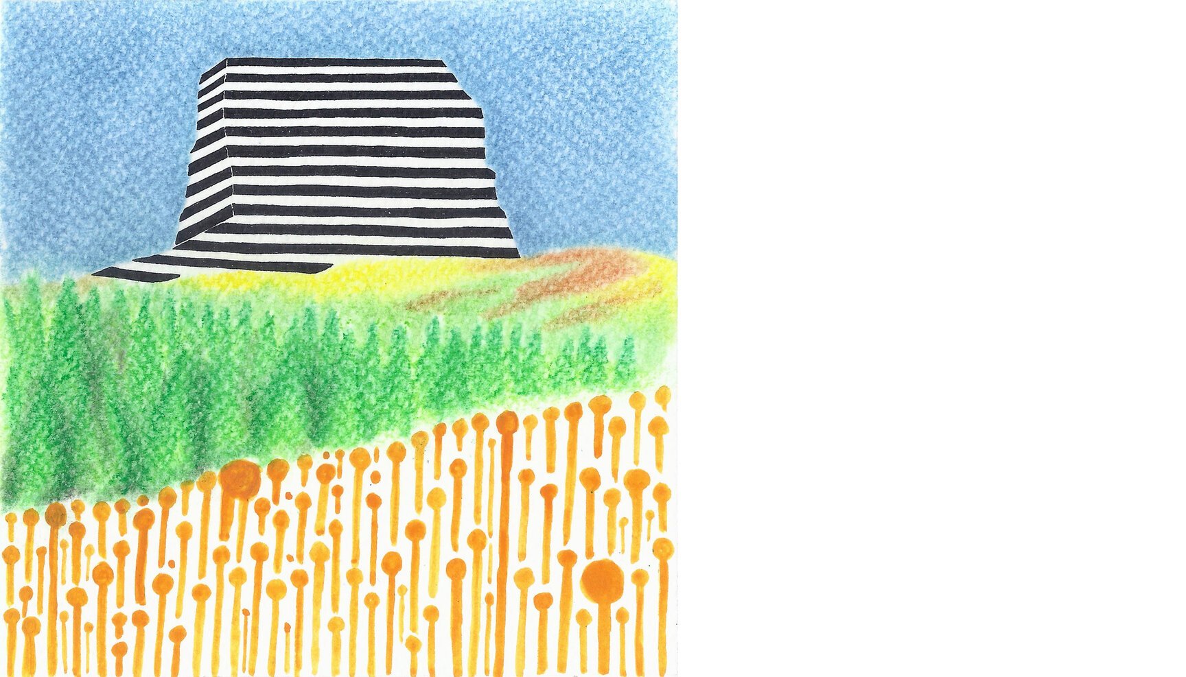
Day 60: Hills around Qianxinan (China)
Day 60 looks over a valley of rapeseed flowers in the town of Qianxinan, Guizhou in China from 24°59’53.82 N 104°55’22.78 E. Though the town of Luoping is more famous among tourists for watching this spectacle of yellow among hundreds of Karst outcroppings, these fields stretch across several other provinces.
These hills in Guizhou province are called ‘Hundred Thousand Hills’ as one can see (from a higher vantage point) these dark green curious looking conical hills stretch far beyond the horizon with the magnificently yellow rapeseed fields in the foreground. The flowers bloom at different times across the country with Luoping being the first to begin during the Spring season.
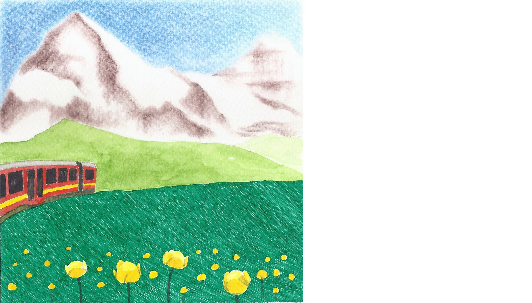
Day 61: Eiger (Switzerland)
Day 61 looks at the classic of mountaineering, Eiger, along with Monch (on the right) from 46°35’05.37” N 7°57’41.10” E.
3,970 metres high, Eiger lies in the Bernese Alps of Switzerland. The ridge from Eiger extends to Monch and Jungfrau (4,158 metres) constituting one the most emblematic sights of the Swiss Alps.
Even more legendary, however, is the north face of the Eiger, called Eigerwand or Nordwand. Rising to 1,800 metres from the meadows at its base, the ‘wall of death’ is considered amongst the most challenging and dangerous ascents and was first climbed in 1938 by an Austrian-German expedition. The peak is incredibly popular and well covered in literature and movies. A well made 2008 movie based on the tragic expedition of 1936, “North Face” or “Nordwand” is highly recommended for its spectacular cinematography.
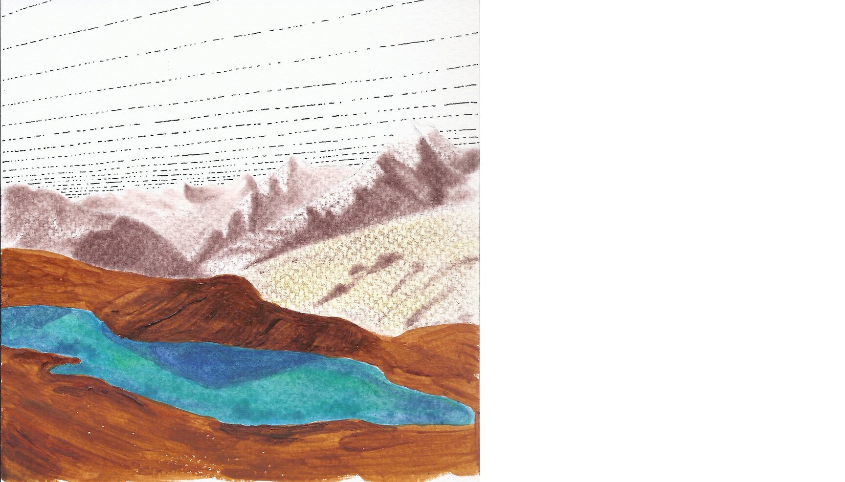
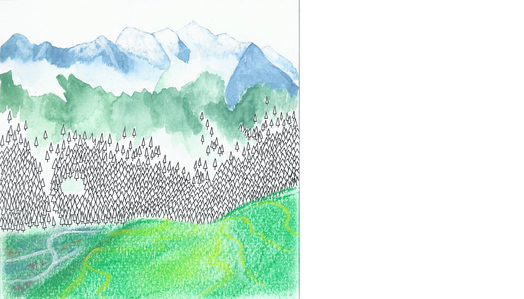
Day 62: Chandra Taal (India)
Day 62 looks down at Chandra Taal from 32°29’38.42” N 77°36’45.91” E.
Chandra Taal which means Lake of the Moon, is a high-altitude lake set at 4,300 metres in Himachal Pradesh.The name of the lake originates from its crescent shape. Situated in Spiti, which is a cold desert this lake is a popular destination for trekkers and campers. The lake comes with beautiful meadows that are ideal for camping but to keep the human footprint low camping is now not allowed close to the banks of the lake.
But when we had gone there, about 9 years back, such restrictions were not in play. As if to compensate, we, a bunch of amateur campers pitched our tent hardly 10 feet away from the lake. True to the inexperience, we not only failed at pitching the tent properly (most of the occupants slipped through the night and many woke up with nightmares of seeing themselves in the lake), we also cooked poorly. But its these little failed things that made it a trip/trek to remember.
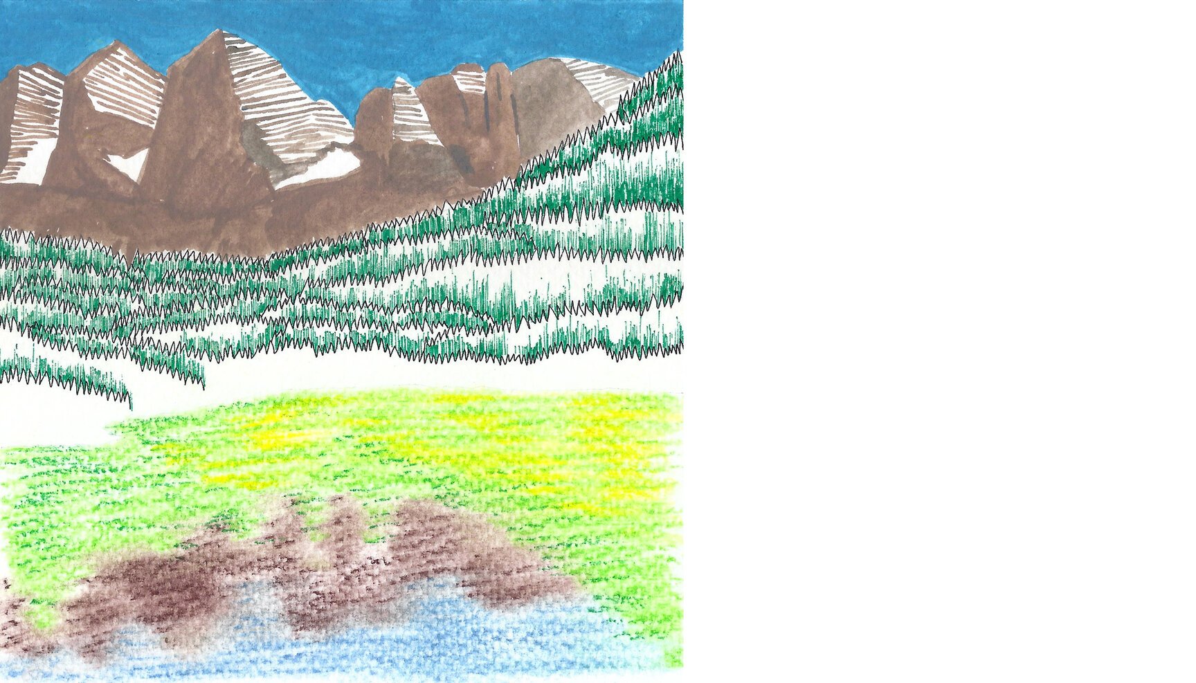
Day 63: Maroon Bells (USA)
Day 63 looks up at the Maroon Bells peaks in the Rocky Mountains of west-central Colorado in the United States from the edge of the Maroon lake (39°05’51.94 N 106°56’35.47 W). This view is reputed to be the most-photographed spot in Colorado.
The US Forest Service refers to the Maroon Bells as “The Deadly Bells” as it is made of “downsloping, loose, rotten and unstable” rock that “kills without warning”. Unlike other mountains in the Rockies that are composed of granite and limestone, these are composed of metamorphic sedimentary mudstone that has hardened into rock over millions of years. Mudstone is weak and fractures readily, giving rise to dangerously loose rock along almost any route. The mudstone is also responsible for the Bells’ distinctive maroon color. The Bells got their “deadly” name in 1965 when eight people died in five separate accidents.
While looking up for what to draw next, i suddenly recalled John Denver’s song ‘Rocky Mountain High’ and went on to listen to it on Youtube ending up listening to several more of his songs which transported me to my school days when i first heard him. That serene feeling was all over me again. The song itself is so beautiful with such a nice message which is still so relevant.
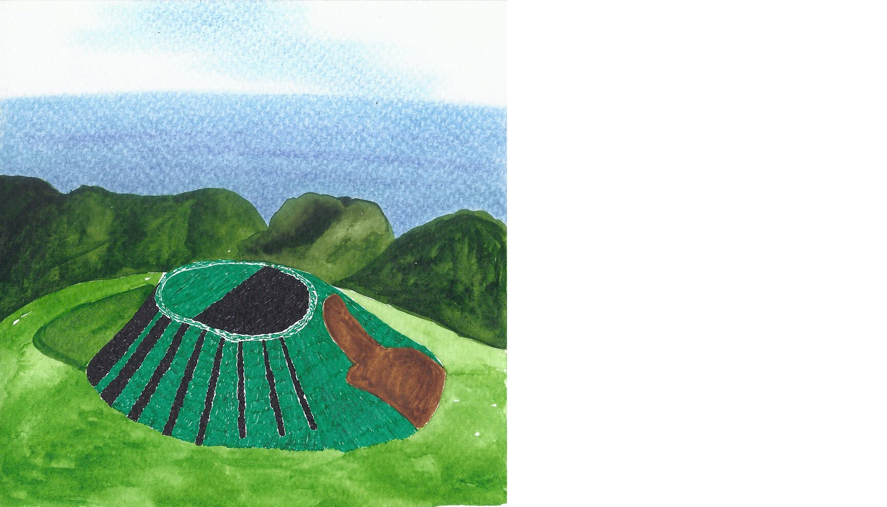
Day 64: Mount Bromo (Indonesia)
Day 64 looks at Mount Bromo, an active volcano in East Java, Indonesia from 7°54’21.56” S 112°56’54.80” E.
The word Bromo comes from Javanese pronunciation of Brahma, the Hindu creator god. Reaching 2,329 meters, it sits in the middle of a vast plain called the ‘Sea of Sand’ that often fills up with a sea of clouds. ‘Sea of Sand’ is devoid of any life and it’s texture gives it a very otherworldly feel.
Mount Semeru, another active volcano, can be seen in the background towering above Bromo.
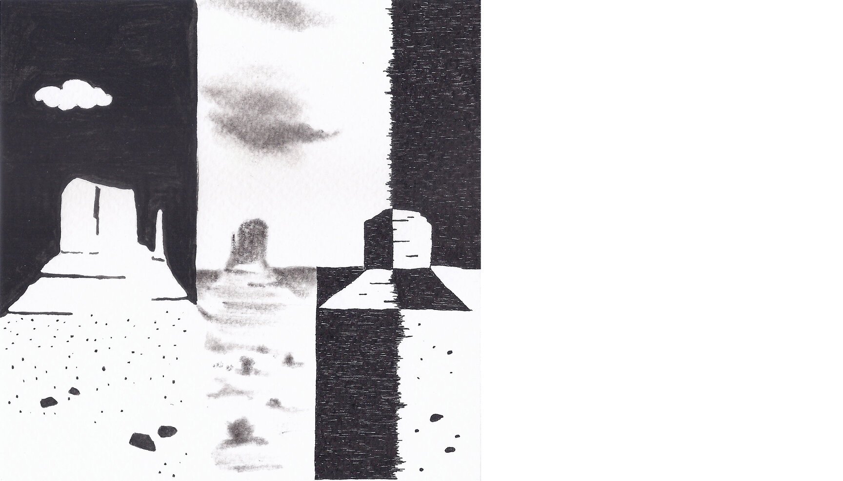
Day 65: Monument Valley (USA)
Day 65 is in Monument Valley and looks at the the iconic view of the three buttes from 36°59’00.99” N 110°06’25.20” W.
Monument Valley, meaning valley of the rocks is a region of the Colorado Plateau characterized by a cluster of vast sandstone buttes, the largest reaching 300 m above the valley floor, which itself lies at 1,500 to 1,800 m. A butte is an isolated hill with steep, often vertical sides and a small, relatively flat top. The valley’s vivid red color comes from iron oxide. The buttes are clearly stratified, with three principal layers.
The three buttes seen here are The Mittens (East and West Mitten Buttes) and Merrick Butte and they form a sort of triangle.
Day 66: Mount Belukha (Russia)
Day 66 looks at the highest peak of the Altai Mountains in Russia. Mount Belukha from the banks of a glacial lake nearby (49°53’42.77” N 86°25’34.48” E). The twin peaked mountain rises along the border of Russia and Kazakhstan, very close to the border of China.Though the Altai mountains are not as high as the other Asian mountain groups, it is very remote and requires a good amount of planning and time to reach. Mount Belukha is equidistant from the three oceans - Pacific, Indian and Atlantic giving it the unique position right in the center of the Eurasia continent.
The glacier saddle between Belukha’s two peaks was used as a site for extracting ice cores to study atmospheric lead concentrations in Russia since 1680. This and other glaciers here have not melted since the last few hundred years. They were formed when snow from years past got compressed under its own weight. As snow always contains traces of the different components of the atmosphere, the atmospheric composition of the past is thus preserved. This research was conducted by a team from the Paul Scherrer Institute, Switzerland in 2001.
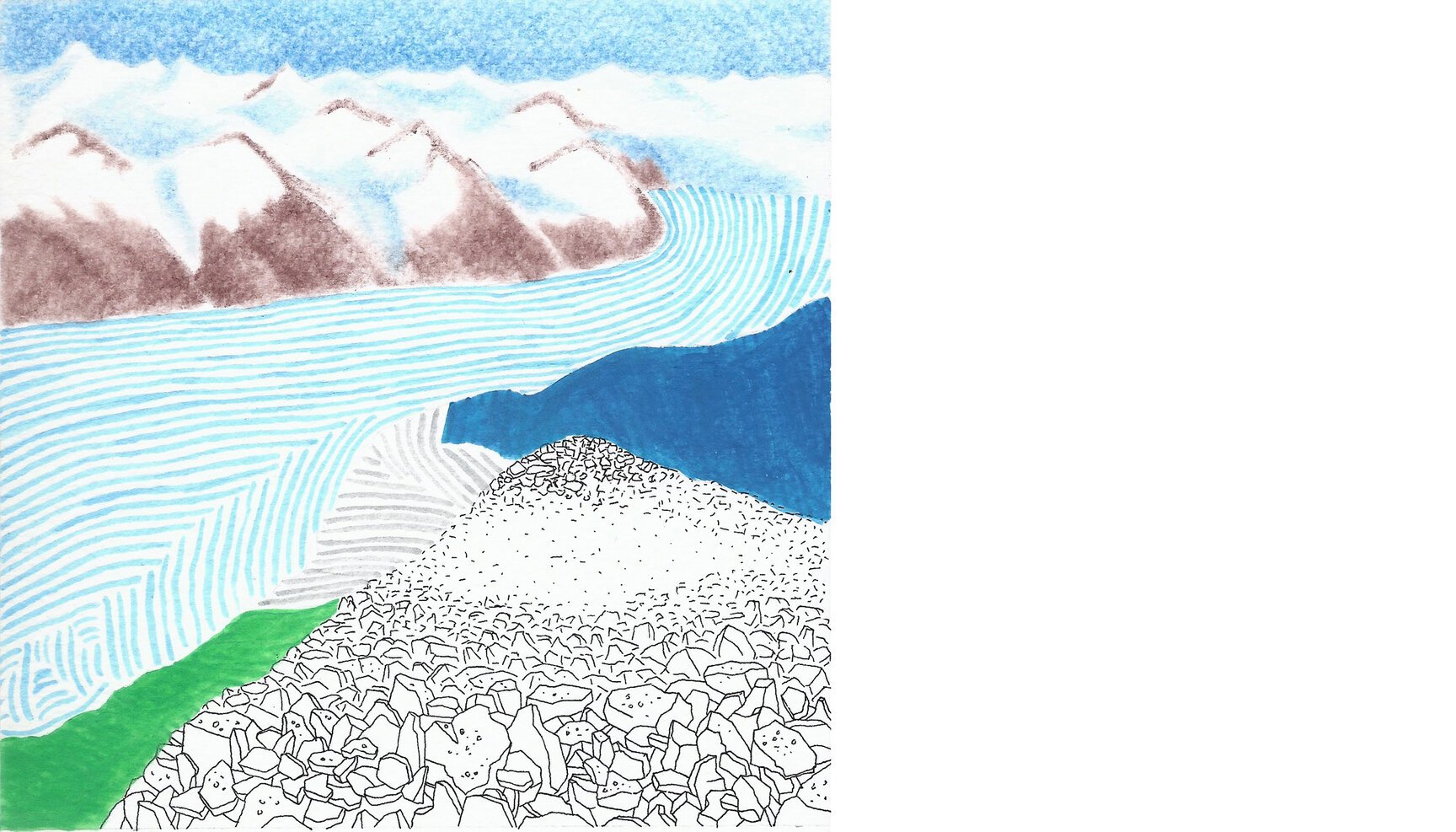
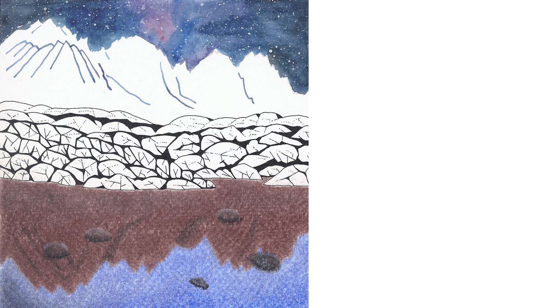
Day 67: Grey glacier (Chile)
Day 67 looks at the massive southern Patagonian ice cap, or the Grey glacier, from the John Gardner pass at 50°56’43.13” S 73°10’56.14” W.
Located in the Chilean Patagonia (South America), Torres Del Paine National Park is famous for its arduous circuit hike of the Paine massif. The John Gardner pass (1,240 meters) lies on the western ridge of this massif and overlooks the rarely seen backside of this massif, offering expansive but unsettling views of the giant Grey glacier below. Someday, if we do land up here, I am sure we would be quaking in our boots looking at Grey.
The pass is named after a British mountaineer who pioneered the circuit trail in 1976.

Day 68: Meteora (Greece)
Day 68 looks at the Holy Monastery of Rousanou of Meteora from 39°43’33.02” N 21°37’56.87” E.
The Meteora that meaning “suspended in air” is one of the largest and most important complexes of Greek Orthodox monasteries in central Greece. The monasteries are built on rock pinnacles of deltaic origin rising over 400m above the Thessalian plain. Chemical analysis and research suggests that the pinnacles were created 60 million years ago in the Tertiary period, emerging from the cone of a river and further transformed by earthquakes. The pillars are of brown sandstone.
Beginning in the 14th century, more than 20 monasteries were built. Six remain today. Of these six, four were inhabited by men, and two by women. Each monastery has fewer than 10 inhabitants.
Day 69: Alpamayo (Peru)
Day 69 marvels at the beauty of Alpamayo, a steep (sixty degrees) and almost perfect icy pyramid in the Cordillera Blanca of the Peruvian Andes from the edge of the glacial lake below at 8°51’20.40” S 77°40’33.65” W.
Alpamayo is one of the most conspicuous peaks in the Cordillera Blanca but strangely it was not even marked in the first map of the range in 1932.
The German magazine ‘Alpinismus’ named it ‘The Most Beautiful Mountain in the World’ in July 1966 resulting from an international survey among climber, photographers, etc.
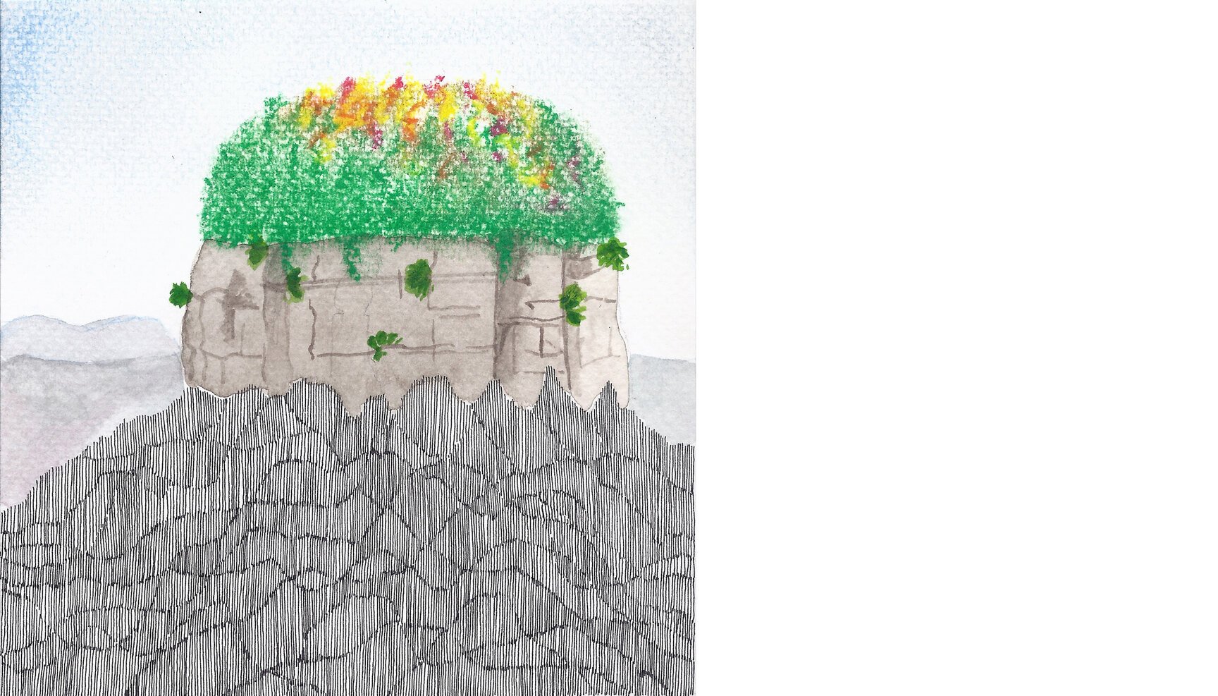
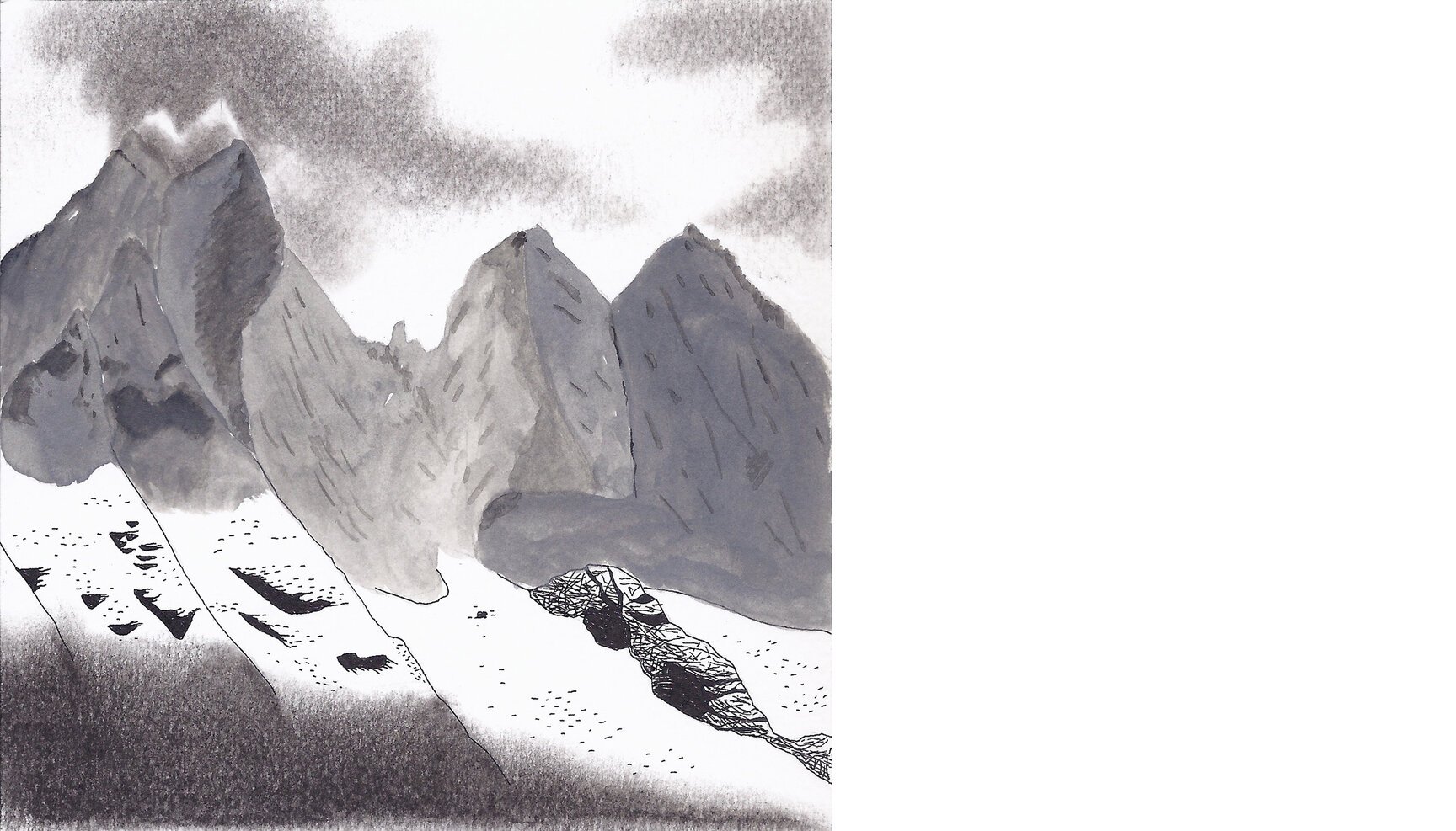
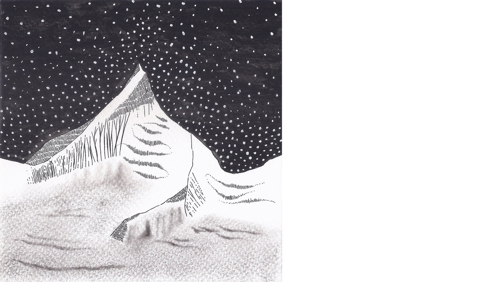
Day 70: Ulvetanna, Kintana and Holtanna (Antarctica)
It’s with a certain sense of pride that we present day 70, part surreal part curious, perhaps the most dramatic of all illustrations we have done to date. It’s a scene from Antarctica, where the ink and pastel colours create a vignette around the corners and the water colours define the highlight in a landscape with hardly any discernible features.
Day 70 stares at Ulvetanna, Kintana and Holtanna in Antarctica from 71°53’53.23” S 8°38’27.64” E.
Lying in the Queen Maud Land of Antarctica, there isn’t any info that we could dig out on Ulvetanna, but the word Kintana or Kinntanna (2725 meters) means molar (tooth) while Holtanna (2650 meters) means the hollow tooth. I guess that’s how these 3 looked like from the aerial survey conducted by the Norwegian expedition of 1956-60 who also named these mountains.
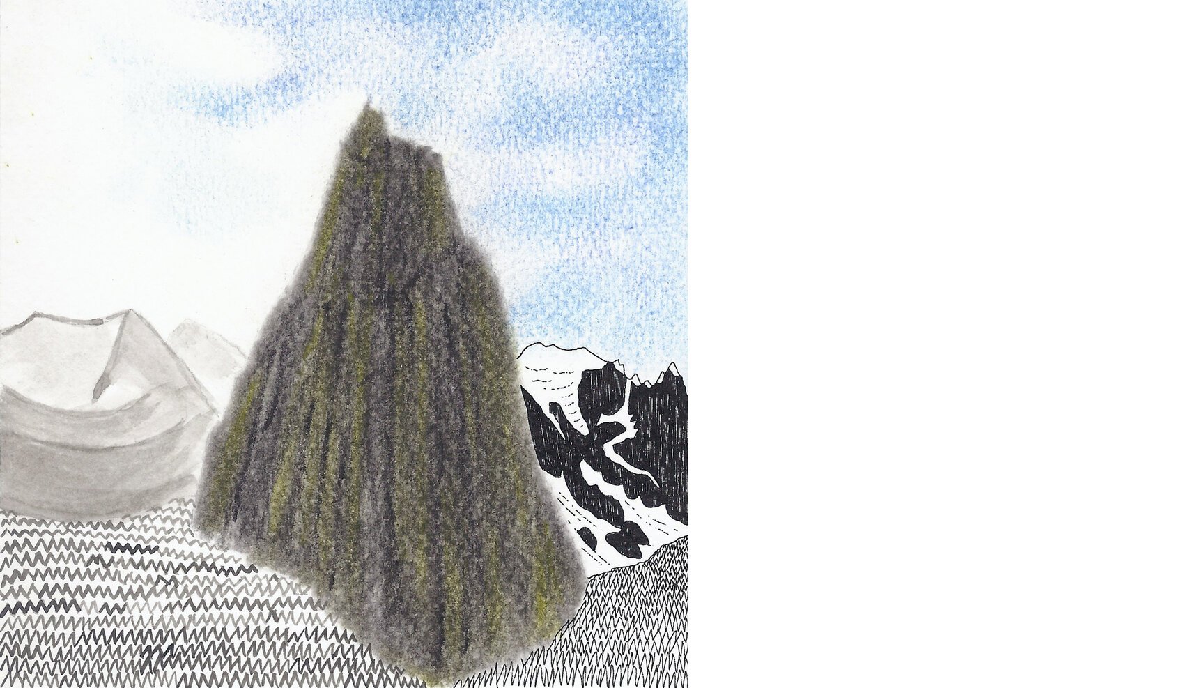
Day 71: Gumbaranjan (India)
Day 71 looks at the stupefying formation of rock & granite called Gumbaranjan from 32°59’50.49” N 77°14’41.62” E.
Not much is known about Gumbaranjan apart from the fact that it is considered holy by the local people, and hence no one has climbed it. We don’t even know how high it is. But it is a landmark on the Padum-Darcha trek and towers on the landscape for almost one full day of walking.
We came across this mountain on our last trek. At first view, when we settled into camp it was shrouded in clouds and looked like it was just a part of its neighbouring range. Next day we descended to the valley floor and after negotiating some terrain and rivers we sat down for lunch. We happened to turn back and look at what we had left behind. And that is when we really SAW Gumbaranjan. It seemed to be so detached from the surrounding landscape and rose into this sky-piercing formation. All the way to the next camp we could hardly stop glancing back.
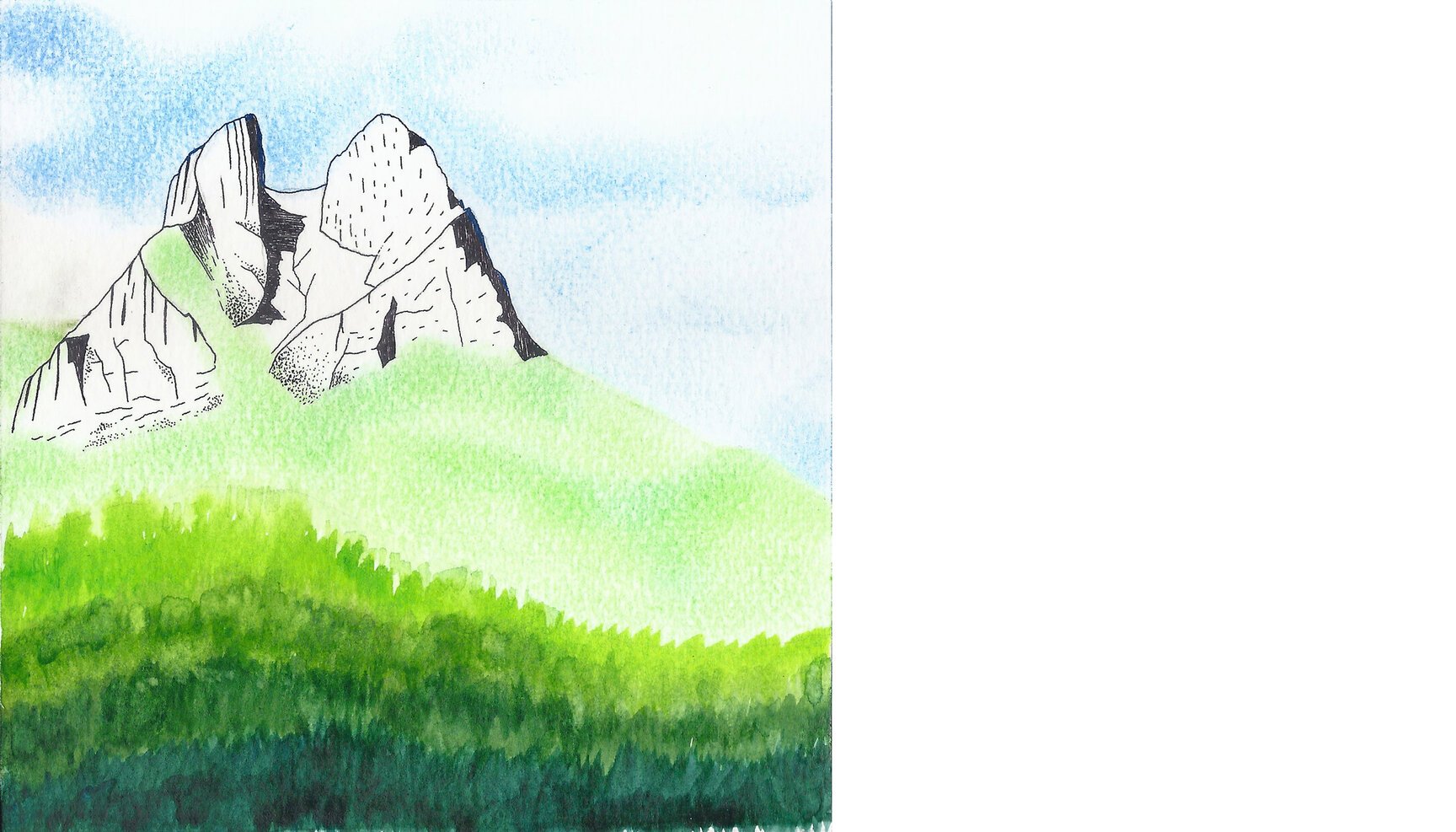
Day 72: Mount Macchapuchchre (Nepal)
Day 72 stares in awe at the splendid mount Macchapuchchre in Nepal from the opposite ridge (28°27’34.14” N 83°50’45.47” E).
Despite a slightly lower elevation compared to its majestic neighbour Annapurna, the Macchapuchchre makes a striking presence with its steep and pointed profile. The peak gets its name from its resemblance to a fish’s tail.
Machhapuchchhre forms the eastern boundary of the Annapurna Sanctuary with an elevation of 6,993 m. Sadly or not, it is barred from climbing as it is considered a sacred peak.
Day 73: Namcha Barwa (Tibet)
Day 73 stares at Namcha Barwa (Top center), the easternmost Himalayan giant from very close to its eastern base at 29°36’12.57” N 94°57’32.38” E.
Namcha Barwa’s (Tibet) claim to fame is it being the easternmost edge of the Himalayas, if one were to consider the traditional definition of the Himalayan spread, between the two mighty rivers of Indus and Bramhaputra. Indus, flanked by Nanga Parbat (8126 meters) on the inside marks the beginning of the Himalayas on the west side, and Bramhaputra, just before it turns 180 degrees to reverse its direction towards India, marks the eastern boundary. And that’s where lies Namcha Barwa (7782 meters), standing just inside the “Great Bend” of the Bramhaputra or Yarlung Tsangpo, as it’s known in Tibet.
Its first ascent came in the year 1992, by a joint team of Chinese and Japanese climbers. And strangely enough, U.K. Alpine Club’s Himalayan Index lists no further ascents.
Day 74: Pico Cristóbal Colón (Colombia)
Day 74 looks at Pico Cristóbal Colón, the highest mountain (5776 metres) in Colombia, from 10°53’51.44” N 73°41’18.84” W.
In Spanish, Pico means peak and seeing who this peak is named after, I assume ‘Cristóbal Colón’ stands for Christopher Columbus. This peak is part of the Sierra Nevada de Santa Martarange (not to be confused with the Sierra Nevadas in California). The Sierra Nevada de Santa Marta is an isolated mountain range separated from the Andes chain and also the highest coastal range in the world.
According to a landmark analysis of every protected area on the planet, the Sierra Nevada de Santa Marta range tops the world’s most irreplaceable nature reserve as the most important concentration of threatened mammals, birds and amphibians take shelter here.
Day 75: Mount Assiniboine (Canada)
Day 75 looks across the Sunburst Lake from a ridge (50°54’51.47” N 115°38’50.72” W) above it at Mount Assiniboine (3,618 m).
The Mount Assiniboine Provincial Park, does not have any roads and thus can only be reached by a six-hour hike (27 km), three hour bike ride (now disallowed to reduce human/grizzly encounters) or helicopter.
The mountain was named by George M. Dawson, a Canadian scientist and surveyor, in 1885. He saw a plume of clouds trailing away from the top of Mount Assiniboine reminding him of the plumes of smoke emanating from the teepees of Assiniboine Indians.
It is also nicknamed the ‘Matterhorn of the Rockies’ but I have started to find it a little putting off that every now and then I come across mountains being referred to as the ‘Matterhorn of …….’. It would be ridiculous if I referred to Denali as the Mount Everest of USA.
Day 76: Zugspitze (Germany)
Day 76 stares at Zugspitze after sundown from 47°25’42.88” N 10°55’46.10” E, or in other words, at the highest mountain of Germany from Austria.
Zugspitze (2962 meters) lies in the Wetterstein Mountains (Alps) and the border between Germany and Austria runs over its western summit because of which a border check point was established right at the summit but was put out of use since the two countries became a part of Schengen zone.
The exact height of the Zugspitze was a matter of debate for quite a while and the various given figures ranged from 2690 to 2970 metres, but it is now generally accepted that the peak is 2962 meters as a result of a survey carried out by the Bavarian State Survey Office. And hence, a hut at the top of the mountain, Münchner Haus, has a lounge named “2962”
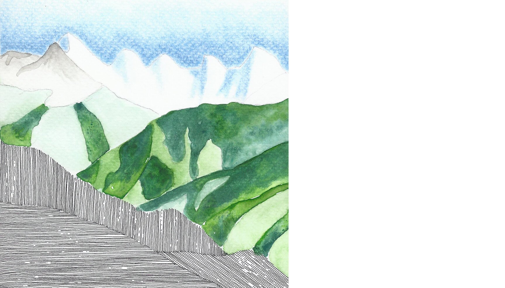
Day 77: Mount Cook or Aoraki (New Zealand)
Day 77 looks at New Zealand’s highest point, Mount Cook/Aoraki from 43°43’21.29” S 170°03’56.57” E, which is bright red mountain hut called Mueller Hut in Hooker Valley.
Located in the Southern Alps, the mountain peaks at 3724m.
The Southern Alps which run the length of the South Island were formed by tectonic uplifting and pressure as the Pacific and Indo-Australian Plates collided along the island’s western coast. The uplifting continues, raising Aoraki / Mount Cook an average of 7 millimetres (0.28 in) each year. However, erosive forces such as high winds and landslides are also powerful shapers of the mountains. Mt Cook lies in the centre of the distinctive alpine fault, a 650 km long active fault in the Southern Alps. It is responsible for the uplift of Mt Cook and is believed to move every 100 to 300 years. It last moved in 1717.
The first layer of watercolour has been inspired by the crazy number of sheep in the country. According to a new report though “The sheep to person ratio in New Zealand has dropped from 20 sheep per person to only seven sheep per person.”
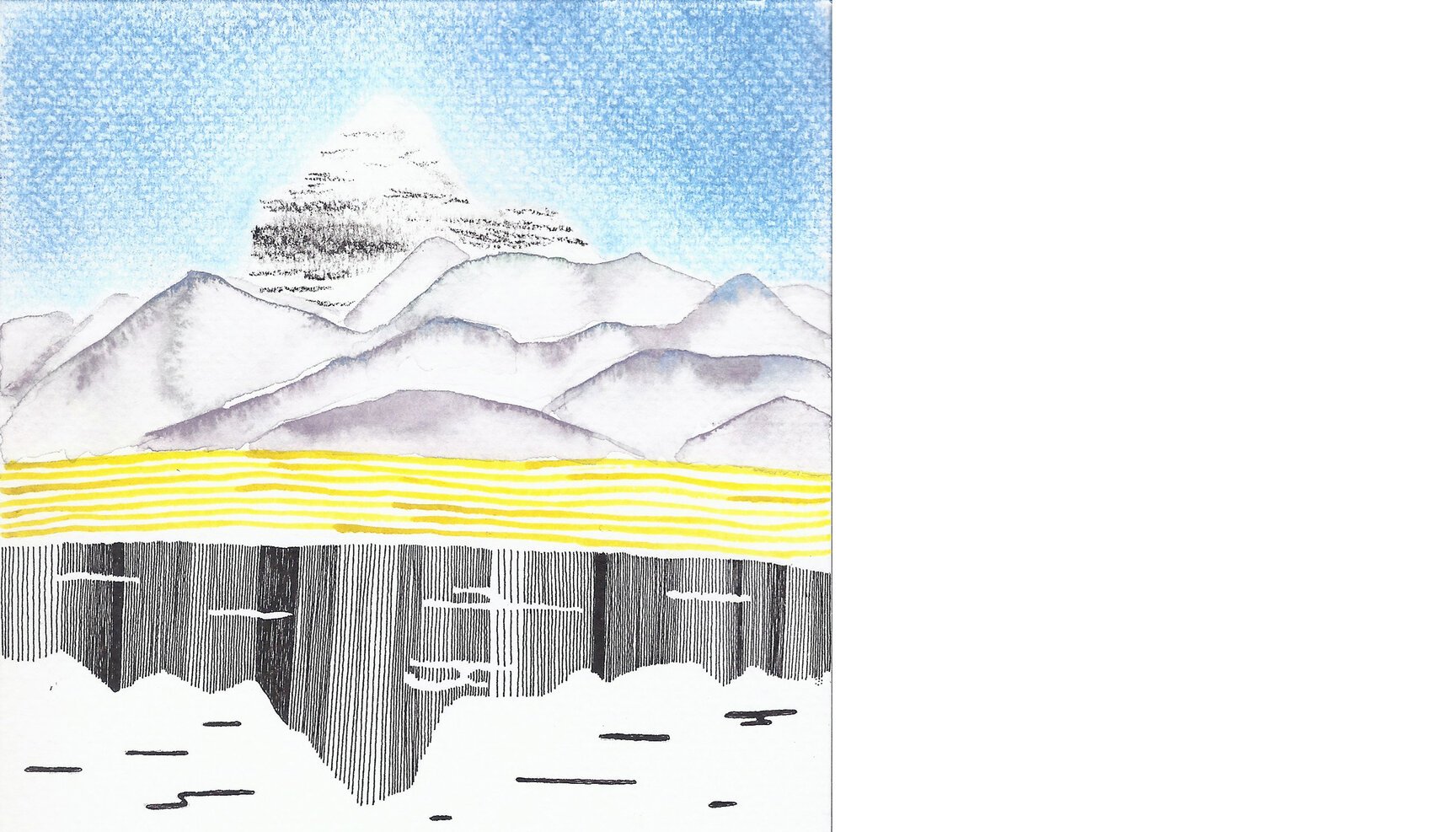
Day 78: Drifika Peak (Pakistan)
Day 78 looks at the sharp snowy profile of the Drifika peak in the Hushe valley of Pakistan from a ridge (35°26’47.41” N 76°28’46.71” E) facing it. It is part of the Karakoram range and is considered to be a difficult climb for even the most seasoned climbers.
The climb to the peak affords views of four 8000 m peaks, K2 and the Gasherbrums (I, II and Broad peak). Though it is only 6,447 m high it serves as a good acclimitisation climb before heading to the eight thousanders.
Day 79: Mount Ararat (Turkey)
Day 79 stares at the Turkish brothers, Little Ararat (left) and Mount Ararat (right) from Armenian fields at 39°49’56.10” N 44°35’20.41” E.
Forming a near-quadripoint between Turkey, Armenia, Azerbaijan and Iran, Mount Ararat (5137 metres) is famous for its association with Noah’s Arc, which is said to have come to rest here according to the Book of Genesis.
A dormant compound volcano, Ararat is a national symbol of Armenia and a holy mountain for Armenians.
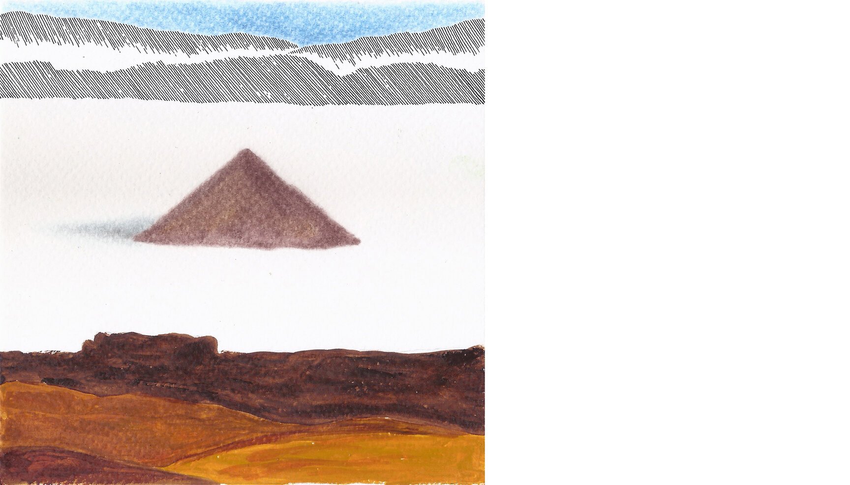
Day 80: Cono de Arita (Argentina)
Day 80 looks at the little and strangely perfect pyramidal mountain in Argentina called Cono de Arita from 25°02’19.72” S 67°46’15.88” W.
Cono de Arita, a volcanic pyramid lies near the south border of Salar de Arizaro, the 6th largest salt flat on earth. An almost perfect cone, it rises unexpectedly (which makes it stand out) in the middle of the salt pan to a modest height of 122 m (though its real height would be 3,460 m more as that is the elevation of the salt pan). Its name comes from the Aymara language where Arita means “sharp”.
In the early twentieth century it was believed that such a perfect cone could only have been built by man. But Cono de Arita is natural and believed to be a small volcano which lacked strength to burst through the curst and so never threw lava or developed a crater. According to the archaeological remains found in the cone, the place was a ceremonial center prior to the arrival of the Incas.
Day 81: Ramparts (Canada)
Day 81 enjoys the Ramparts range in the Canadian Rockies from the beautiful Amethyst lake at 52°41’06.76 N 118°14’40.77 W.
The range has 10 named summits and is part of the Continental Divide that runs along the Americas. The Amethyst lake and the Ramparts are part of a very popular trekking and skiing route with two outfitters camps on the shores of the lake.
Day 82: Minya Konka (China)
Day 82 is about Minya Konka (29°35′45″N 101°52′45″E) in China. It is the easternmost 7,000 m peak in the world. Interestingly in 1930, Austrian-American explorer, geographer, linguist and botanist, Joseph Rock, miscalculated the height of the peak to be 9,220 m and cabled the National Geographic Society to announce Minya Konka as the highest mountain in the world. The claim was suspected to be an error by the Society and was rightly revised by Joseph Rock after a discussion to 7,803 m. The actual height of the peak is 7,556 m.
Day 83: Aconcagua (Argentina)
Day 83 traces the lines of Aconcagua (32°39′12.35″S 70°00′39.9″W), the highest mountain outside Asia, at 6,960.8 metres and the highest point in the Southern Hemisphere. It lies just 15 km from the Argentinian border with Chile. Being one of the seven summits, Aconcagua is considered the highest non-technical mountain in the world, since the northern route does not require ropes, axes, and pins. It is still called the “Mountain of Death” since a lot of climbers underestimate the perils of high altitude and cold weather up on the mountain. The mountain also sees a massive number of climbers which leads to human waste disposal problems. Currently, from two base camps (Plaza de Mulas and Plaza Argentina), over 120 barrels of waste (22,500 kg approximately) are flown out by helicopter every season.
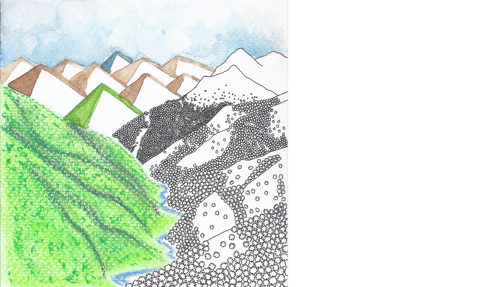
Day 84: Kamet (India)
Day 84 looks at the Kamet peak, the second highest mountain in the Garhwal region of Uttarakhand from a ridge (30°51’45.56 N 79°29’56.87 E) above the village of Ghastoli. One of the meanings for the name given by Frank Smythe, in his book Kamet Conquered, is that it has originated from the Tibetan word Kangmed meaning the ‘lower snows’ compared to the ‘higher snows’ of the Kailash range to the east.
Kamet was the first summit over 25,000 ft (7,620 m) to be climbed, and was the highest summit reached until the first ascent of Nanda Devi five years later. A. M. Kellas, a Scottish chemist, explorer, and mountaineer, and his companion H. T. Morshead conducted scientific studies during their 1920 expedition on Kamet focusing on the physiology of high altitude travel and acclimatization, and on the possibility of using supplemental oxygen. These studies eventually proved useful on the expeditions to Mount Everest.